Winter Watch
❄️ Get winter weather alerts and snow maps, delivered to your inbox.
By John Waller, Jack Pickell, and Heather Alterisio
Morning satellite loop of the very strong Nor'Easter producing powerful winds and very heavy snow across the Northeast. Blizzard conditions and crippling impacts will continue through much of today for the region. 🛰️❄️ pic.twitter.com/VOy5UB48lh
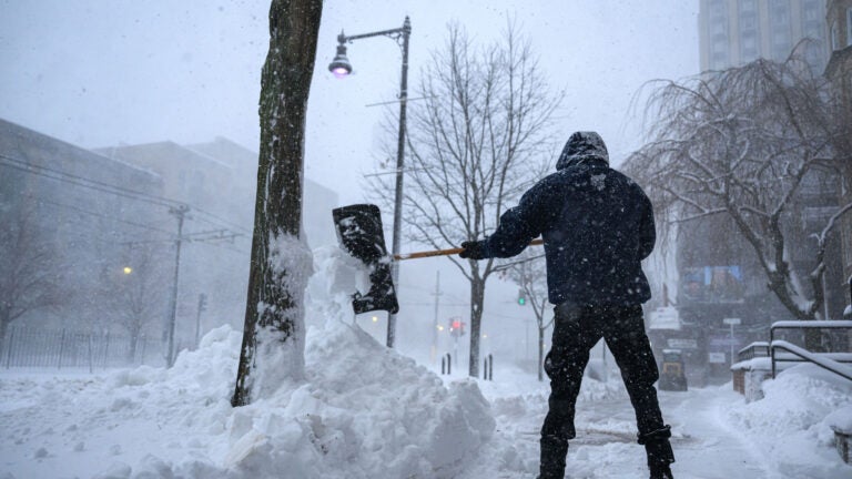
— NWS Weather Prediction Center (@NWSWPC) February 23, 2026
[Monday Blizzard Update]
— NWS Boston (@NWSBoston) February 22, 2026
❄️Highest snowfall amounts: 18-24 inches with pockets up to 30 inches possible
🚨Greatest risk for tree damage and power outages is in southeast MA and RI where 55-75 mph wind gusts combine with heavy, wet snow.
🕑Heaviest snowfall rates 4 am-noon pic.twitter.com/cermW1kWeC
[Potentially Historic/Destructive Storm southeast of the BOS-PVD corridor] We are very concerned for areas southeast of the Boston-Providence corridor where wet snow combines with northeast wind gusts of 60-70 mph. Power outages & tree damage. Worst conditions Mon 4 am to noon. pic.twitter.com/8NHt3mkDIP
— NWS Boston (@NWSBoston) February 22, 2026
THUNDERSNOW!
— Cindy Fitzgibbon (@Met_CindyFitz) February 23, 2026
2:40am you can see 6 lightning strikes being detected by radar in the heavy band of snow south of Narragansett Bay. These heavy snow bands are pivoting N&W. Expect intensity of snow to pick thru 4am and continue with 2-4"/hr rates at times thru 11am #WCVB pic.twitter.com/q0rtdpjk1O
6:25AM … This heavy band is producing snowfall rates of 2-3"/hr+ with numerous reports of THUNDERSNOW! This band will pivot gradually N&W thru 11am. Snow will really pile up in SE MA. #WCVB pic.twitter.com/2Ra3ppXY3E
— Cindy Fitzgibbon (@Met_CindyFitz) February 23, 2026
7AM WIND GUSTS…
— Cindy Fitzgibbon (@Met_CindyFitz) February 23, 2026
50-70mph! Winds continue near and a bit over this magnitude peaking midday and don't ramp down until after sunset. >100k power outages in MA already (per MEMA) and near whiteout conditions #WCVB pic.twitter.com/CPQYxaQmbI
PEAK WIND GUSTS…
— Cindy Fitzgibbon (@Met_CindyFitz) February 23, 2026
as of 8am >70mph on the Cape and Islands #WCVB pic.twitter.com/OjjsnW2J56
SNOW REPORTS AS OF 8AM…
— Cindy Fitzgibbon (@Met_CindyFitz) February 23, 2026
More than 1ft in SE MA #WCVB pic.twitter.com/EtH5NQTu0w
Shifted zones south just a wee bit. Could see 2FT+ where mesoscale bands set up. Most likely in white zone. But… bands are tricky. Expect surprises. #Storm #Blizzard #Boston #Weather #Noreaster #springisstillcoming pic.twitter.com/CYQl5rIwGV
— Dave Epstein (@growingwisdom) February 23, 2026
This is the banding we talk about. Notice how dark blue it all is. That's the 2-in per hour kind of stuff inside that band. #blizzard pic.twitter.com/yzYnxduL8S
— Dave Epstein (@growingwisdom) February 23, 2026
A #blizzard isn't just any type of snow storm. pic.twitter.com/NkgC2qS29L
— Dave Epstein (@growingwisdom) February 23, 2026
Officially blizzard conditions at Logan airport past hour, two more in a row and we have a bona fide offical #Blizzard. pic.twitter.com/JJsa9fseNL
— Dave Epstein (@growingwisdom) February 23, 2026
Blizzard update, highest totals across SE Mass push to 2 feet for many. Gusts 60-70+mph coast. pic.twitter.com/dZqVssVw5Q
— Chris Lambert (@clamberton7) February 23, 2026
Snow rates running 2-3” per hour, with occasional thunder, in Southeast Mass and RI now. pic.twitter.com/KnYUgd7N3h
— Chris Lambert (@clamberton7) February 23, 2026
Snow totals rapidly increase this morning… here are several so far. Double digits parts of Southeast Mass already. pic.twitter.com/f4O1HJT3SB
— Chris Lambert (@clamberton7) February 23, 2026
Gusting 70mph+ on the Islands now. pic.twitter.com/EMT6vPTqag
— Chris Lambert (@clamberton7) February 23, 2026
Peak gusts so far… Chatham to Nantucket pushing to/past 70mph already. pic.twitter.com/iSxPyudBr8
— Chris Lambert (@clamberton7) February 23, 2026
Afternoon high tide is a bit lower astronomically lower than the morning high tide. Coastal flood advisory up, not expecting anything more than minor coastal flooding. pic.twitter.com/vX4QsPYC2m
— Chris Lambert (@clamberton7) February 23, 2026
Take a look at the hour-by-hour snowfall and wind gust forecast here. STAY HOME! Whiteout, blizzard conditions are expected with power outages. pic.twitter.com/hh98g8vnSD
— Shiri Spear (@ShiriSpear) February 23, 2026
Are you ok Nantucket? @boston25 @vickigrafwx pic.twitter.com/TXYwFf2bPI
— Shiri Spear (@ShiriSpear) February 23, 2026
Check out WHEN TO SHOVEL @boston25 #boston #newengland #Massachusetts #newhampshire pic.twitter.com/Kb8f7A12aA
— Shiri Spear (@ShiriSpear) February 23, 2026
Gladly accepting snow reports – tell us your town & total to share on air @boston25 @vickigrafwx pic.twitter.com/AF6Qqqxv8S
— Shiri Spear (@ShiriSpear) February 23, 2026
WEATHER UPDATES: Our new nor'easter snow map shows parts of the Greater Boston area getting over two feet. https://t.co/nGKBSrziwA pic.twitter.com/X3Rm4ewI8f
— NBC10 Boston (@NBC10Boston) February 23, 2026
Best chance to see more than 2 feet…inland portions of Plymouth and Bristol counties pic.twitter.com/im68Yu7NSS
— Terry Eliasen (@TerryWBZ) February 22, 2026
Snowfall totals as of 7am… pic.twitter.com/elaTPwe4o8
— Terry Eliasen (@TerryWBZ) February 23, 2026
Visibility down to zero in many coastal and southeast Ma locations pic.twitter.com/1uhDvnrqsJ
— Terry Eliasen (@TerryWBZ) February 23, 2026
❄️ Get winter weather alerts and snow maps, delivered to your inbox.
Stay up to date with everything Boston. Receive the latest news and breaking updates, straight from our newsroom to your inbox.
To comment, please create a screen name in your profile
To comment, please verify your email address
Conversation
This discussion has ended. Please join elsewhere on Boston.com