Here’s what Boston meteorologists are saying about the snow forecast for Wednesday
“It’s not the snow amounts, it’s the impact."
It’s a roller coaster of temperatures and weather conditions this week for the Greater Boston area, with high temperatures forecast near 60 degrees on Tuesday and snow predicted for Wednesday.
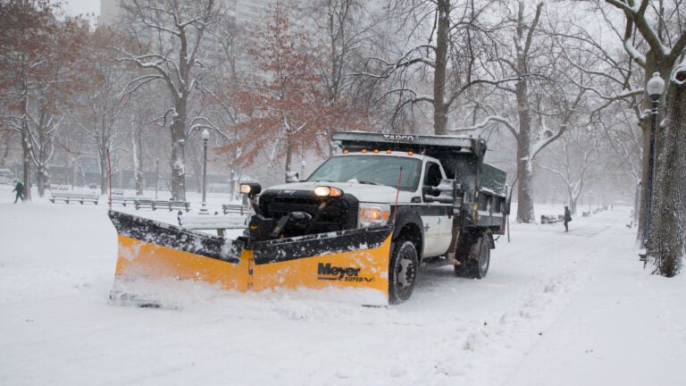
While Boston will most likely see about 2 inches of snow by 7 p.m. Wednesday night, Bill Simpson, a meteorologist with the National Weather Service, warns to not let the relatively low accumulation fool you.
“It’s not the snow amounts, it’s the impact,” he said.
The snow “should hold off” through Tuesday’s evening commute, according to Simpson. Boston is predicted to see a high temperature of 58 degrees that day.
“We have a rain event through [Tuesday] evening,” Simpson said. “Then the cold air comes through.”
With the falling temperatures, the Wednesday morning commute “could be icy,” he said. Wednesday’s high is supposed to reach just 34 degrees. Simpson noted that while the snow is predicted to be “winding down” Wednesday night, it could affect the evening commute as well.
OK New England, now that we have your attention again…
After rainy/mild weather Mon/Tue rain changes to snow early Wed AM w/some accumulation before ending in the afternoon, possibly affecting Wed AM commute. Here’s a 1st call on accums & prob of 2″ or more. pic.twitter.com/GWMmcjJa8D
— NWS Boston (@NWSBoston) December 9, 2019
“Temps come crashing down Wednesday with a flip from RAIN to SNOW,” Cindy Fitzgibbon, a meteorologist with WCVB, said. “Looks slippery for the Wednesday AM commute.”
Big warm up on the way with near record highs tomorrow! Warmth + rain = rapid snowmelt and poor drainage flooding. Temps come crashing down Wednesday with a flip from RAIN to SNOW. Looks slippery for the Wednesday AM commute #wcvb pic.twitter.com/wNote2o6Hj
— Cindy Fitzgibbon (@Met_CindyFitz) December 9, 2019
Downpours and snow melt will make for a difficult evening commute. Watch for clogged storm drains leading to poor drainage flooding. Showers Tuesday will be followed by a flip to SNOW with falling temps Wednesday morning. Tough commute expected #wcvb pic.twitter.com/1w5mMKDOi3
— Cindy Fitzgibbon (@Met_CindyFitz) December 9, 2019
“Up and down temperatures this week,” Terry Eliasen, a meteorologist with WBZ, said.
Up and down temperatures this week pic.twitter.com/JXQBxPY9Kv
— Terry Eliasen (@TerryWBZ) December 9, 2019
Looks like rain will change to snow late Tuesday night and perhaps accumulate a bit for the Wed AM commute. Typically these “anafrontal” rain to snow situations dont produce much snow, but something to watch pic.twitter.com/lSHaDWFY90
— Terry Eliasen (@TerryWBZ) December 9, 2019
“Slick travel possible Wednesday morning with refreeze/falling snow,” Chris Lambert, a meteorologist with WHDH, said.
https://twitter.com/clamberton7/status/1203995823031377921


To comment, please create a screen name in your profile
To comment, please verify your email address
Conversation
This discussion has ended. Please join elsewhere on Boston.com