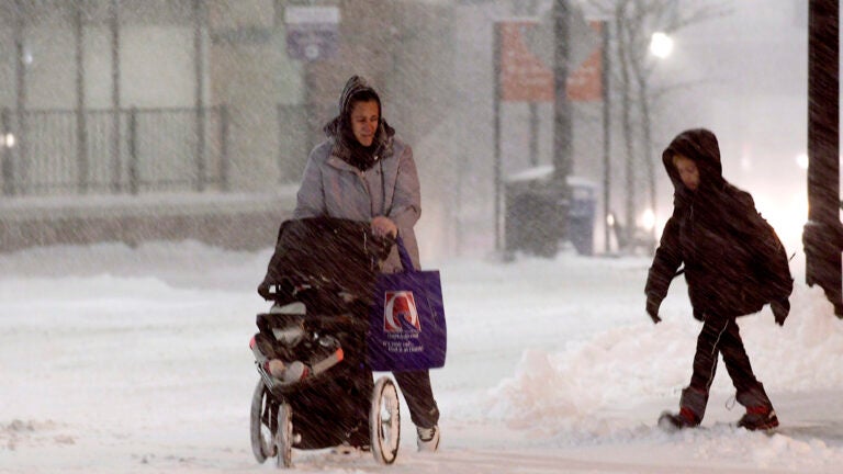
Here’s what Boston meteorologists are saying about the ‘prolonged winter storm’
More snow is on the way, according to forecasters.
Related Links
National Weather Service: ‘We are in the middle of a prolonged winter storm.’
[5 AM Update] Good morning! We are in the middle of a prolonged winter storm, and here are the expected ADDITIONAL snow totals from early this morning through Tuesday morning. Check out your hour-by-hour forecast to see when you can expect snow: https://t.co/4AwbQ0yOoN pic.twitter.com/hr40vsQr2a
— NWS Boston (@NWSBoston) December 2, 2019
[8:30 am] latest observed #snow totals from late yesterday & overnight. Sharp gradient from not much snow across northern portions of #CT #RI into interior eastern #MA to 6-12″ over northern MA! The jackpot so far, 16.4″ in Rowe, MA (northwest Franklin county). More snow tngt! pic.twitter.com/6T1XjQyFB6
— NWS Boston (@NWSBoston) December 2, 2019
David Epstein: ‘Watch for icy spots to develop [Monday] as colder air moves south post 3 p.m.’
2 air masses sitting over southern New England today. Can lead to some enhancement of snow/snow showers right where these meet during today. Central Essex County, northern Middlesex, Worcester and Franklin Counties also vulnerable. Could be coating to 3″ of snow in spots. pic.twitter.com/q9dFlpcX7g
— Dave Epstein (@growingwisdom) December 2, 2019
Watch for icy spots to develop today as colder air moves south post 3 p.m. pic.twitter.com/0QYoGiVXU2
— Dave Epstein (@growingwisdom) December 2, 2019
As storm wraps up east of New England tonight and Tuesday it will put eastern areas on western side of storm. This is still a fluid (pun intended) situation. Updated snow map this afternoon could go a bit lower/higher with new information. pic.twitter.com/RtZkXDRrH2
— Dave Epstein (@growingwisdom) December 2, 2019
Pockets of enhanced snow showers/steady snow today. Coating to a few inches in spots through the evening. pic.twitter.com/Au6nLL2gPx
— Dave Epstein (@growingwisdom) December 2, 2019
Michael Page, NBC10 Boston and NECN: ‘Your drive to work around Greater Boston will be much more wintry [Tuesday] than [Monday].’
PART 1: congratulations! Part 1 of our 3 part storm is done. It left more than a foot of snow in parts of Western New England. Here’s a rough estimate based on your reports. pic.twitter.com/Wtj7InrqBp
— Michael Page (@MichaelPageWx) December 2, 2019
PART 3: remember, the final burst of snow comes tonight and during the Tuesday morning commute. Your drive to work around Greater Boston will be much more wintry tomorrow than today. A rough idea of what’s still to come in terms of snow. pic.twitter.com/1sgH1qk7qu
— Michael Page (@MichaelPageWx) December 2, 2019
Jeremy Reiner, 7News: ‘Steady-heavy snow late [Monday]-Tuesday AM.’
Monday Morning: Coastal front keeps the light snow going inland today (esp north/west of Boston). Front sags south this eve changing light rain to snow tonight along coast. Steady-heavy snow late tonight-Tuesday AM. Snow map shows additional accumulation on the way. #7news pic.twitter.com/zHENfA2Sax
— Jeremy Reiner (@jreineron7) December 2, 2019
Pamela Gardner, NBC10 Boston and NECN: ‘Long duration storm continues.’
Long duration storm continues. Milder temps near the coast and all rain, mix to snow across central MA and in the Merrimack Valley. So far several inches of snow on the ground. We stay as a mix, rain southeast this afternoon and a gusty onshore wind. @NBC10Boston @NECN pic.twitter.com/jXVS8OuHtT
— Pamela Gardner NBC10 Boston (@Pamelanbcboston) December 2, 2019
Pockets of minor coastal flooding on NE facing beaches during this afternoon’s high tide. Waves 10-15′ offshore will create splashover and some erosion too. @NBC10Boston @NECN pic.twitter.com/4ouXIKxrEI
— Pamela Gardner NBC10 Boston (@Pamelanbcboston) December 2, 2019
Wintry mix today, gusty NE wind. We convert to all snow around midnight from west to east and as colder air wraps in. Snow will accumulate to several more inches by Tuesday morning. @NBC10Boston @NECN pic.twitter.com/olXUn8ZqOf
— Pamela Gardner NBC10 Boston (@Pamelanbcboston) December 2, 2019
Sarah Wroblewski, WBZ: ‘Some towns that were above freezing, have now dropped… black ice/slippery roads may develop.’
Generally light scattered showers today… temps near to below freezing north and west will lead to additional snow accumulation. Gusty showers over SE MA, but be aware as temps drop this evening for icy spots to develop. #WBZ #WBZThisMorning pic.twitter.com/pKwgYJqtKH
— Sarah Wroblewski (@sarahwroblewski) December 2, 2019
Eyes on developing snow tonight into Tuesday… additional significant accumulations are possible. Where banding sets up… Few spots may even see over 6″ #WBZ pic.twitter.com/9NrwuOd6KP
— Sarah Wroblewski (@sarahwroblewski) December 2, 2019
A WINDY day as well.
Strong to damaging winds possible today over the Cape & Islands. Scattered tree damage & isolated power outages possible. #WBZ pic.twitter.com/rgB9ya6Shh— Sarah Wroblewski (@sarahwroblewski) December 2, 2019
If traveling along the coast later today… Minor coastal flooding & splashover during high tide this afternoon… fortunately tides are running astronomically low during this event. #WBZ #WBZThisMorning pic.twitter.com/lV4AVZtcsC
— Sarah Wroblewski (@sarahwroblewski) December 2, 2019
Some towns that were above freezing, have now dropped… black ice/slippery roads may develop. #WBZ pic.twitter.com/5rVrutY0DR
— Sarah Wroblewski (@sarahwroblewski) December 2, 2019
A reminder temps will continue to crash towards the coast/SE today… icy spots likely to develop as snow begins to ramp up again overnight. #WBZ pic.twitter.com/FlPL58P9kK
— Sarah Wroblewski (@sarahwroblewski) December 2, 2019
Shiri Spear, Boston 25 News: ‘The winds will stay busy [Monday] & [Tuesday] with gusts commonly 30-40 mph, possibly as high as 50 mph.’
Honestly, the Tuesday morning commute looks like the worst one…@CatherineNews @JBrewerBoston25 @boston25 pic.twitter.com/SF7ehpis9P
— Shiri Spear (@ShiriSpear) December 2, 2019
Here’s what I’m expecting today before a change back to snow tonight. Some slick spots north & west of #boston. @boston25 pic.twitter.com/TNzAJRDfTF
— Shiri Spear (@ShiriSpear) December 2, 2019
Wet & slick roads are expected locally today. Plan for a SLOW drive tomorrow AM. @boston25 @CatherineNews pic.twitter.com/DEBfHfjer6
— Shiri Spear (@ShiriSpear) December 2, 2019
New numbers just in! How are the roads in your town? Wet, slushy or snowy? @boston25 pic.twitter.com/KgwtV3JKsb
— Shiri Spear (@ShiriSpear) December 2, 2019
The winds will stay busy today & tomorrow with gusts commonly 30-40 mph, possibly as high as 50 mph. @boston25 pic.twitter.com/fCABWD3CC7
— Shiri Spear (@ShiriSpear) December 2, 2019
Here’s what @JBrewerBoston25 & I see for additional snowfall. Minor accumulation during the day today. Most of this falls Tuesday AM. @boston25 pic.twitter.com/f7AqIhtWvg
— Shiri Spear (@ShiriSpear) December 2, 2019
Matt Noyes, NBC10 Boston and NECN: ‘[Tuesday’s] AM commute looks much worse for immediate Boston Metro & inside Route 495.’
As seen this morning on TV: Check this out – first image is our exclusive @NBC10Boston / @NECN forecast system prediction that was valid at 7 AM today. Second is prediction for 7 AM tomorrow. Tomorrow’s AM commute looks much worse for immediate Boston Metro & inside Route 495. pic.twitter.com/QzVtjwNOgq
— 1DegreeOutside (@1DegreeOutside) December 2, 2019
Chris Lambert, 7News: ‘Wet roads through the afternoon along and east of I-95… colder on west side of coastal front where ice/snow falls.’
Wet roads through the afternoon along and east of I-95… colder on west side of coastal front where ice/snow falls. pic.twitter.com/58XYnAFZVO
— Chris Lambert (@clamberton7) December 2, 2019
Moderate to heavy snow widespread across eastern Mass tomorrow morning. For many towns/cities along and east of I-95, tomorrow mornings commute is worse than today. Snow covered roads widespread. pic.twitter.com/33YcQgWwOK
— Chris Lambert (@clamberton7) December 2, 2019
Light snow lingers til noon before getting kicked out east. pic.twitter.com/UUP3XtIA6k
— Chris Lambert (@clamberton7) December 2, 2019
Zack Green, WBZ: ‘December 2nd’s 90-year old record of 6″ should hold but we have a chance of breaking the 126-year December 3 record!’
December 2nd’s 90-year old record of 6″ should hold but we have a chance of breaking the 126-year December 3 record! https://t.co/OQ9zK26u8m
— Zack Green (@zackgreenwx) December 2, 2019
https://twitter.com/zackgreenwx/status/1201492406702612480


To comment, please create a screen name in your profile
To comment, please verify your email address
Conversation
This discussion has ended. Please join elsewhere on Boston.com