
Sign up for Scenic Six
Navigate the endless possibilities of New England travel with Boston.com.
Hikers looking for worthwhile trails beneath dazzling canopies of color this fall have plenty of options in Massachusetts.
Ahead, discover nine parks the Massachusetts Department of Conservation & Recreation (DCR) recommends for hiking this fall season.
This 12.7-mile rail trail, which connects the towns of Adams, Cheshire, and Lanesborough, is an excellent place for leaf peeping. It offers a 10-foot wide “gentle-grade, universal-designed path,” noted DCR, and has four parking areas along the trail.
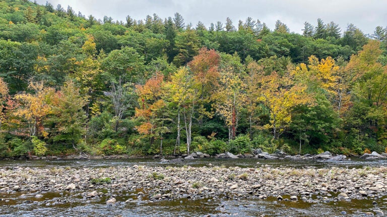
You’ll enjoy views from a 35-acre man-made pond on this 1.7-mile interpretive trail in the 12,000-acre forest. The pond was named for dairy farmer Fred Benedict (1866-1930), who owned the surrounding area.
There are more than 25 miles of hiking trails in this 5,000-acre forest and this easy, two-mile trail is a great introduction to them, according to DCR. The forest also contains a Wampanoag reservation, an old quarry, and historic Civilian Conservation Corps structures.
Hikers on this scenic 1.2-mile hike around Hallockville Pond pass by an “immense” glacial erratic, according to DCR. It’s also worth checking out the “impressive” stone ruins of a sawmill, tannery, and dam on the Mill Site Trail, DCR noted.
Treat yourself to “gorgeous” views of the Deerfield River and the Deerfield River Valley on this 4-mile loop, according to DCR. From the park’s headquarters, hikers should hike to the end of the road, take a right onto the Indian Trail, and then bear right onto the Mohican-Mohawk Trail near Charlemont. This hike is considered difficult.

“Excellent views will be your reward, especially in the fall when the surrounding trees start turning brilliant colors,” wrote DCR about this 4.2-mile roundtrip journey that includes the summit of South Sugarloaf along with North Sugarloaf vistas. This trail, also known as the Summit Trail, is considered difficult.
Check out the fall colors from Wright’s Tower on this 6.9-mile loop, which rewards visitors with “spectacular views of Boston and the surrounding area,” according to DCR. Hikers will find trailheads at Bellview Pond, Long Pond, and Sheepfold parking area.
It’s one of the longest rail-trails in southern Massachusetts, stretching 22 miles from Franklin State Forest to Douglas State Forest. The trail, often called SNETT, is mostly gravel and has marked entrances in all six towns it runs through: Bellingham, Blackstone, Douglas, Franklin, Millville, and Uxbridge.
Soak in the pond views on this easy three-mile path. To get to it, park on Webster Street (Route 16) and head north on the gravel path before turning right on Ridge Trail and then left onto Wallis Pond Loop Trail.

Navigate the endless possibilities of New England travel with Boston.com.


To comment, please create a screen name in your profile
To comment, please verify your email address
Conversation
This discussion has ended. Please join elsewhere on Boston.com