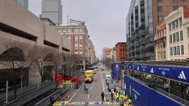
Marathon Monday is one of Boston’s busiest days of the year, and numerous streets will be closed to traffic as runners make their way towards the famous finish line on Boylston Street.
City officials have urged residents and visitors to find other ways than driving to get around, such as the MBTA and the Bluebikes system. However, if you still end up on the road on race day, beware of these road closures and parking restrictions.
No stopping is allowed Monday on the following streets:
Arlington Street (both sides), Beacon Street to Isabella Street
Beacon Street, Back Bay (South side, Public Garden side), Charles Street to Arlington Street
Beacon Street, Brighton (both sides), Chestnut Hill Avenue to Brookline Line
Belvidere Street (both sides), Huntington Avenue to Massachusetts Avenue
Berkeley Street (both sides), Columbus Avenue to Commonwealth Avenue, unless otherwise posted
Blagden Street (both sides), Huntington Avenue to Exeter Street, unless otherwise posted
Boylston Street (both sides), Massachusetts Avenue to Dalton Street
Bromfield Street (both sides) from Tremont Street to Washington Street
Cambria Street (both sides), Boylston Street to Hynes Convention Center loading dock
Charles Street South (both sides), Park Plaza to Boylston Street
Chestnut Hill Avenue (both sides), Commonwealth Avenue to Beacon Street
Clarendon Street (both sides), Commonwealth Avenue to Columbus Avenue, unless otherwise posted
Cleveland Circle (both sides, parking area adjacent to Cassidy Playground and parking area adjacent to Sutherland Road) from Beacon Street to Chestnut Hill Avenue
Columbus Avenue (both sides), Arlington Street to Dartmouth Street
Commonwealth Avenue (inbound), Beacon Street (Kenmore Square) to Hereford Street
Commonwealth Avenue, Charlesgate West to Deerfield Street (outbound)
Commonwealth Avenue, Lake Street to Chestnut Hill Avenue (inbound)
Congress Street (north side, Faneuil Hall side), State Street to Hanover Street
Dalton Street (both sides), Boylston Street to Clearway Street
Dartmouth Street (both sides), Saint James Avenue to Columbus Avenue
Deerfield Street (both sides), Commonwealth Avenue to Bay State Road
East Dedham Street (both sides), Harrison Avenue to Albany Street
Exeter Street (both sides), Commonwealth Avenue to Newbury Street
Fairfield Street (both sides), Boylston Street to Commonwealth Avenue
Gloucester Street (both sides), Commonwealth Avenue to Boylston Street
Hanover Street (both sides), Tileston Street/Clark Street to Battery Street
Hereford Street (both sides), Commonwealth Avenue to Newbury Street
Huntington Avenue (northwest side), Blagden Street to Massachusetts Avenue
Kenmore Street (both sides), Newbury Street to Beacon Street
Nassau Street (both sides, for Tufts Medical), from Washington Street to Harrison Avenue
Newbury Street (both sides), Arlington Street to Brookline Avenue, unless otherwise posted
New Chardon Street (both sides), Merrimac Street to Cambridge Street
Plympton Street (both sides), Harrison Avenue to Albany Street
Providence Street (both sides), Arlington Street to Berkeley Street
Raleigh Street (both sides), Bay State Road to Beacon Street
Stanhope Street (both sides), Berkeley Street to Clarendon Street
Scotia Street (both sides), Dalton Street to St. Cecilia Street
St. Cecilia Street (both sides), Belvidere Street to Boylston Street
State Street (both sides), Congress Street to Washington Street
Tremont Street (both sides), Cambridge Street/Beacon Street to Stuart Street
Trinity Place (west side, hotel side), St. James Avenue to Stuart Street
Washington Street (both sides), Bromfield Street to State Street
Washington Street (both sides), from Oak Street to Nassau Street
Washington Street (east side), from Nassau Street to Kneeland Street
Some streets will also be unavailable for parking during the Patriots’ Day Parade, which kicks off at 9:15 a.m. with a ceremony at City Hall Plaza. Parking restrictions will be in place on the following streets:
Congress Street (north side, Faneuil Hall side), State Street to Hanover Street
Hanover Street (both sides), Congress Street to Commercial Street
State Street (both sides), Congress Street to Washington Street
Tremont Street (both sides), Cambridge Street/Beacon Street to Stuart Street
Washington Street (both sides), Winter Street to State Street
Bromfield Street (both sides), Tremont Street to Washington Street
City officials have made available a fully-detailed map showing the marathon route and road closures by day, which can be viewed here.
Sign up for the Today newsletter
Get everything you need to know to start your day, delivered right to your inbox every morning.


Be civil. Be kind.
Read our full community guidelines.To comment, please create a screen name in your profile
To comment, please verify your email address