Sign up for the Today newsletter
Get everything you need to know to start your day, delivered right to your inbox every morning.
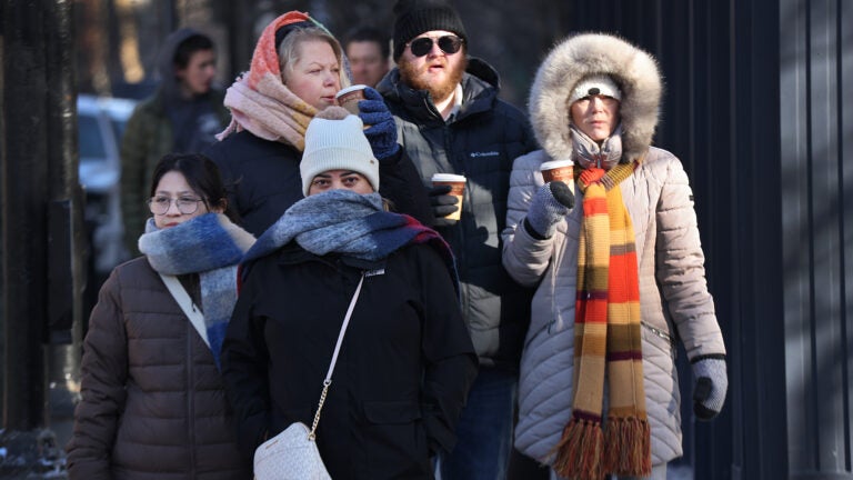
With the new year and a new month upon us, our first weekend of January is looking calm and tranquil — although it will be cold. If you’re looking to partake in outdoor activities, at least you won’t have to worry about any snow or ice.
A storm system that brought rain to the area the middle part of the week will be in northern Quebec at the same time a new massive ocean storm starts developing hundreds of miles to our east this weekend. This upper-level pattern is going to pull down much colder air than we saw at the end of December and the start of the new year.
Temperatures are going to be below freezing and below average Friday through the weekend under sunny skies all three days. In terms of departure from normal temperatures, the coldest weather will actually be south of us, but it will be plenty chilly here.
Friday will be the least cold day with temperatures reaching the mid- to upper 30s, but the Augusta wind will make it feel a lot colder. Morning wind chills will be in the upper teens to 20s.
Look for highs only reaching around 30 degrees on Saturday and Sunday. The wind will continue to be gusty throughout the weekend, knocking wind chills back into the teens and perhaps even single digits first thing in the morning.
Turning colder this weekend, but not pure arctic air at all. Nightime lows in the teens. If Boston puts together a few days at or under 30, it is just typical January stuff. There are over 100 records of 4 or more such streaks in the books. Here are some of the longest. pic.twitter.com/JCn8pj6u0B
— Dave Epstein (@growingwisdom) January 2, 2025
The cold will cause an icy layer on many lakes and ponds, although it will not be at its required 4 inches or greater depth for safety just yet. Older ice is also weaker, so we have to wait for the new ice to form and grow for the greatest support.
Saturday morning will also mark something we call “perihelion.” This is when the Earth is at its closest to the sun as our planet follows its elliptical orbit orbit. This may seem counter-intuitive since it’s the coldest time of the year, but the angle of the sun is much more important than the changing distance throughout the year.
But the good news is this weekend means our sunrises start getting earlier, so now we are gaining time in both the afternoon and the morning.
Southern New England: Look for breezy and cold conditions throughout the weekend with temperatures around 30 degrees, starting near 20 each morning.
Western Mass.: Look for partly the mostly cloudy skies this weekend with temperatures in the 20s. The winds will continue to be gusty especially in the afternoon both days.
Cape and Islands: Look for blustery conditions both Saturday and Sunday. Temperatures will reach near freezing but start in the 20s each morning.
Northern New England: Wind will be the main weather feature this weekend along with colder temperatures. Readings will be in the 20s during the day and single digits and teens at night.
Get everything you need to know to start your day, delivered right to your inbox every morning.


To comment, please create a screen name in your profile
To comment, please verify your email address
Conversation
This discussion has ended. Please join elsewhere on Boston.com