Winter Watch
❄️ Get winter weather alerts and snow maps, delivered to your inbox.
Our weekend storm is now meandering around Nova Scotia and New Brunswick, but it’s not done with us just yet. This storm has intensified into a very powerful storm across Eastern Canada and the gradient between that system and high pressure over Central Canada is going to create a lot of wind today, Presidents’ Day — up to 60 mile-an-hour gusts. As a matter of fact, we have high wind warnings and wind advisories in place for the entire region.
The strongest wind is going to run from Greater Boston through the Worcester Hills and into the Berkshires, while also hitting the higher elevations of Northern New England. Even where the winds are not at peak, they will still be strong enough to create scattered power outages.
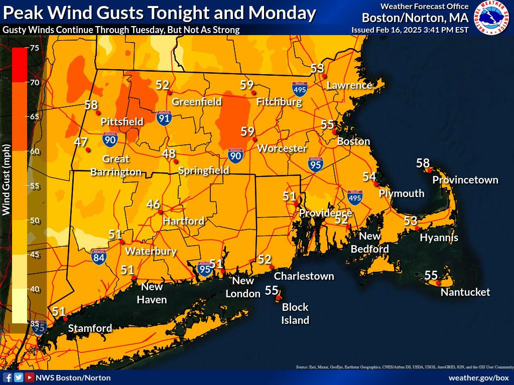
I expect many areas will see peak gusts over 50 miles per hour and some 60 mile-per-hour numbers are possible. It’s likely that power outages are going to be an issue just about anywhere today. The number of outages will ultimately depend on where the trees start going down and how many wires they take out.
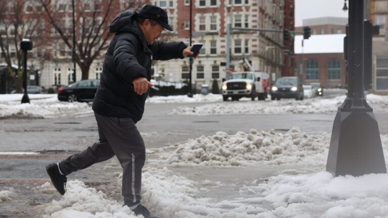
Other than the wind, you’ll notice the cold. Temperatures today are only going to be in the 20s and when you add in those gusty winds, wind chill values — how it feels outside — will be between 4 and 15 degrees for much of the day. This is definitely a bundle-up holiday.
If you are headed skiing, be aware there are probably going to be significant lift holds and these are likely to continue, although to a lesser extent, into Tuesday. If you have not taken advantage of winter sports yet, this is a great week overall, with some of the deepest snow cover of the season and cold temperatures.
But it will be dry today and sunshine will be prevalent.
The strong winds will continue into Tuesday, with a wind advisory in place across much of New England until later in the afternoon when those winds start to subside. Temperatures on Tuesday are going to be starting in the teens and only end up between 20 and 25 in the afternoon. Tuesday night will be cold with readings only between 5 and 15 degrees.
Our next storm threat
The temps rise a little, reaching 25 to 30 on Wednesday, then our eyes turn back to the Atlantic and the next storm threat. I’m using the word “threat” because that’s all it is at the present time. The storm is going to be an enormous ocean monster, but as scary as that may sound, it could just stay far enough out to sea that it has little to no impact on us in New England.
The worst-case scenario would be a serious nor’easter striking late Thursday into Friday or the whole thing may just stay so far away that we get some cloudiness and perhaps some flurries over the Cape and the islands. Presently, I’m leaning toward little to no impact with light snowfall. There will not be any mixed precipitation with this event, no matter what happens.
Then it’s back to dry weather Friday into the upcoming weekend.
Monday’s breakdown
Greater Boston: Windy and cold conditions today with temperatures in the 20s with sunshine and passing clouds.
Central and Western Mass.: A high warning today for gusty winds 40 to 60 mph with sunshine and a few clouds with highs in the 20s.
Cape and Islands: Wind advisories in place for today with sunshine and temperatures just under 30 this afternoon.
Rhode Island: Sunshine today with blustery conditions and cold temperatures. Highs 25 to 31.
New Hampshire: Wind advisories are in place for the northern areas with high wind warnings south for today. A few snow showers in the mountains and sunshine elsewhere. Highs 15 to 25 statewide.
Vermont: Look for high wind warnings today with a few snow showers at times. Highs 15 to 20.
Maine: Wind advisories are in place for the state today. Highs in the 20s at the coastal plain and teens in the hillier terrain with snow showers there.
❄️ Get winter weather alerts and snow maps, delivered to your inbox.


To comment, please create a screen name in your profile
To comment, please verify your email address
Conversation
This discussion has ended. Please join elsewhere on Boston.com