Snow is expected on Tuesday, and it may be the biggest storm of the season for some people
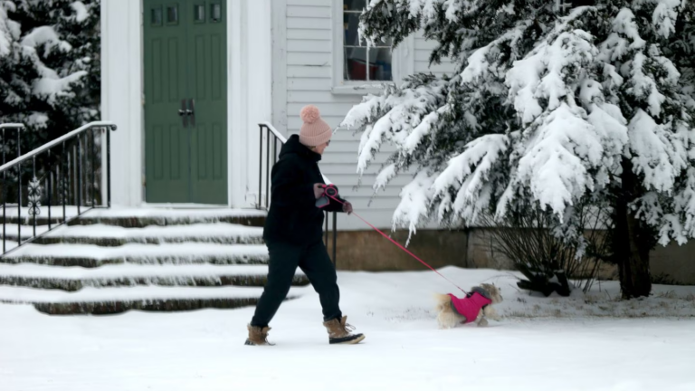
There was a little bit of snow over the past couple of days in most of the area reminding us that although meteorological winter comes to an end this week, the potential for cold and snow will last for several more.
You’ve all likely heard that there is a snow event coming here late Monday night and, especially, during Tuesday. This is still in the cards. While it will certainly not be a blockbuster storm, it will produce enough snow for the plows to be called out and is likely to be the largest storm we have seen, so far, this winter.
Snowfall totals this snow season are just over 10 inches in Boston, a couple of feet below where we would typically be by this point in the winter. You can see the typical totals for an entire winter below.

Clouds will increase during Monday. Snow will hold off until late in the evening likely around midnight. When you get up Tuesday morning, it will be snowing steadily across most of the area. Many school days will be called off, and some impact to Logan Airport’s schedule is also likely.
This is not a storm where wind, power outages, or coastal flooding will be an issue. The forecast challenge is going to be at what point milder air changes the snow to rain across Southeastern Massachusetts and how much snow falls before this happens.
Another aspect I am evaluating is does the rain-snow line make it to Boston? As of now, I think there is likely a few hours of rain during the second half of the storm in the city.
If it snows a little longer than expected, the higher range of the totals will ensue. Because temperatures will be quite a bit milder over Cape Cod and Plymouth county, the snow will be heavier and wetter and not pile up as efficiently. This is why I have lower numbers there.

Nevertheless, everybody should see it look like winter on Tuesday. The slow nature of the storm system to the South means that snow and rain could linger well into the evening Tuesday.
That rain-snow line will be pushing up into Eastern Massachusetts, and I think it’s likely that Boston will see rain before the whole thing ends. A change to the predicted snow totals would likely move the lines farther east or west, but I don’t expected the ranges themselves to change much if at all.
The snow and rain will end around or before midnight, setting us up for a pretty nice Wednesday with sunshine and melting temperatures in the 40s. Another storm system brings some rain or very wet snow Wednesday night. Thursday temperatures will be quite a bit above average with more melting.

Another storm approaches the area Friday or Saturday, and this could bring significant amounts of rain and snow, as well.

Daily Local Weather Forecast
-
Today April 10Partly sunny62° 49°
-
Sat April 11Mostly sunny60° 41°
-
Sun April 12Mostly cloudy52° 46°
-
Mon April 13Showers68° 61°
-
Tue April 14Intermittent clouds72° 53°
-
Wed April 15Cloudy73° 59°
-
Thu April 16Mostly cloudy71° 56°
powered by:


To comment, please create a screen name in your profile
To comment, please verify your email address
Conversation
This discussion has ended. Please join elsewhere on Boston.com