Are you ready for 60-degree temperatures? Here’s what to know about the midweek warmup.
The warmest day of the week is going to be Wednesday ahead of the front when many areas could make a run at 60 degrees.
A new work week is underway and although many of you are likely off today you might be already thinking about weather and commute impacts later this week. We do have an evolving pattern underway and in spite of the incredibly mild conditions the past several days there’s wintry weather in the forecast.
We went from the coldest Christmas Eve and Christmas Day combination since the early ‘80s to one of the warmest New Year’s Eves on record. Boston even tied a high temperature record on Dec. 30th of at 63 degrees.
Cold air up in Canada is poised to nose its way into New England later this week. Ahead of it will be some showers Tuesday as the warm air makes one more push northward and more rain Wednesday as the cold air begins to return.
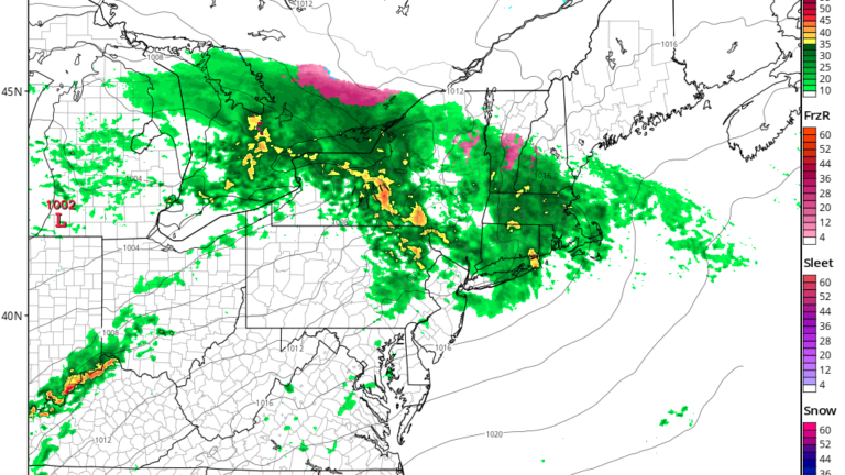
The most difficult part of the forecast comes Thursday night through Friday. This is when below-freezing temperatures will be returning north to south. At the same time southwesterly winds at the higher levels of the atmosphere will bring clouds and moisture. This setup can lead to snow, sleet, and even freezing rain. It doesn’t appear that this would be a significant system, but I think everybody knows it takes very little to cause problems on the roads.
I think there’s going to be three separate chances of precipitation in the coming days. The first will be Tuesday afternoon with the surge of mild air. This will be rain.
The next will come Wednesday evening as a cold front slips south. This will again be rain but towards Thursday morning there may be enough cold air that some of the northern areas well north of the Mass Pike see a little bit of frozen precipitation.

Then on Friday, another system could skirt the area with the chance for some mixed rain or snow. At this early point, precipitation could be very light or non-existent, but there is also a chance of some accumulating snow, albeit on the light side. None of this looks like a lot of moisture.

The warmest day of the week is going to be Wednesday ahead of the front when many areas could make a run at 60 degrees. The record for the date is 64 set back in 1950. I don’t believe temperatures will be that warm. Conditions will then turn much more seasonable in the longer range but I still don’t see any deep cold air in the medium range.

Finally, in these early days of 2023 we can look back to the previous year and note that it was tied for the fourth warmest on record. Our climate continues to warm, mostly due to human-induced greenhouse gases, and there’s no reason to think the trend is going to slow down.

Daily Local Weather Forecast
-
Today April 17Partly sunny69° 50°
-
Sat April 11Mostly sunny58° 40°
-
Sun April 12Mostly cloudy52° 46°
-
Mon April 13Showers65° 58°
-
Tue April 14Intermittent clouds66° 56°
-
Wed April 15Intermittent clouds80° 59°
-
Thu April 16Mostly cloudy71° 52°
powered by:


To comment, please create a screen name in your profile
To comment, please verify your email address
Conversation
This discussion has ended. Please join elsewhere on Boston.com