Here’s what local meteorologists are saying about the potential snow forecast later this week
"Who's ready for some #snow?"
Related Links
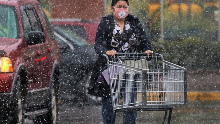
Some areas of Massachusetts could see their first snow of the season at the end of the week, just before Halloween, according to local meteorologists.
But that depends largely on timing, the National Weather Service said.
“It’s all going to depend on how quickly the cold air comes in,” Matthew Belk, a meteorologist with the service, said. “It looks like it would be a possibility for a light snowfall Thursday night into Friday.”
However, being several days away, the forecast could greatly change. For areas west of I-495 and the Worcester Hills, with temperatures projected to be around freezing in those areas early Friday, there’s a greater possibility of snow, according to Belk.
For the greater Boston area, it’s possible there could be “a snowflake in the air” Thursday night into Friday, but Belk said snow accumulation isn’t expected.
Who’s ready for some #snow?
Although best chance of seeing minor accumulation (couple of inches) is near Berkshires & in Worcester County, areas shaded in light blue are the most likely locations to see some snow Thu night into Fri AM. Stay tuned! pic.twitter.com/1v1o39ol2i
— NWS Boston (@NWSBoston) October 26, 2020
The precipitation is projected to come from when “remnants” of Tropical Storm Zeta pass through Friday into Friday night, according to the service in a hazardous weather outlook set for Massachusetts east of Berkshire County, Rhode Island and Northern Connecticut. Zeta is forecast to bring wind that could affect Cape Cod and the islands.
The outlook notes that particularly for higher elevations, rain could change to snow before it stops Friday or Friday night.
Here’s what other local meteorologists said about the potential snow:
David Epstein: ‘Cold high pressure could mean our first flakes of the season Friday from #Zeta’s moisture.’
Here’s a little loop showing how #Zeta will move into the Gulf and then through the Tennessee valley passing south of New England. Cold high pressure could mean our first flakes of the season Friday from #Zeta‘s moisture. pic.twitter.com/YPhCxR5LWn
— Dave Epstein (@growingwisdom) October 26, 2020
Halloween looks really cold. At least it doesn’t last. pic.twitter.com/zB30aV1u0r
— Dave Epstein (@growingwisdom) October 26, 2020
Michael Page: ‘Highest odds are north & west of Boston.’
There are 3 factors we’re watching as this comes together:
Storm now bringing snow to Colorado will scoop up some moisture from #Zeta.
That bring us rain as early as Thursday.
As that ends Friday, chilly air from Canada rushes in.
Timing on all of that determines snow chance. pic.twitter.com/GZhVOMoqi8
— Michael Page (@MichaelPageWx) October 26, 2020
Mike Wankum, WCVB: ‘As the moisture from “Zeta” arrives in New England we could see some steady rain on Thursday. After that it gets interesting.’
As the moisture from “Zeta” arrives in New England we could see some steady rain on Thursday. After that it gets interesting. A following coastal low may grab some of this moisture on Friday and produce inland snow flakes early Friday morning. #wcvb pic.twitter.com/rFl1ub2KVS
— Mike Wankum (@MetMikeWCVB) October 26, 2020
The map on Friday morning. Notice the wet snow inland. In order for that to happen a lot of things need to go just right (or wrong). It’s something I’ll be watching this week as the remnant moisture from hurricane Zeta move in. #wcvb pic.twitter.com/mlnECbpRfJ
— Mike Wankum (@MetMikeWCVB) October 26, 2020
Eric Fisher, WBZ and CBS News: ‘If you had Hurricane Zeta striking the Gulf Coast and leading to a chance of pre-Halloween snow in New England on your 2020 bingo card, it’s time for an upgrade to powerball tickets’
If you had Hurricane Zeta striking the Gulf Coast and leading to a chance of pre-Halloween snow in New England on your 2020 bingo card, it’s time for an upgrade to powerball tickets.
Where is the potential most likely? Interior and with elevation. Watching trends all week. #wbz pic.twitter.com/oOUn2rJBxA
— Eric Fisher (@ericfisher) October 26, 2020
Trending 📈❄ pic.twitter.com/L5so36C8BA
— Eric Fisher (@ericfisher) October 26, 2020
Giant honking area of high pressure for #Halloween 🎃 looking chilly, clear, and dry. pic.twitter.com/k8BuMOo7gE
— Eric Fisher (@ericfisher) October 25, 2020
Matt Noyes, NBC10 Boston and NECN: ‘Any late week storminess, be it raindrops, snowflakes or both, should be gone by Halloween…but cold air in the wake of the storm will remain’
Any late week storminess, be it raindrops, snowflakes or both, should be gone by Halloween…but cold air in the wake of the storm will remain. By trick-or-treat time (for those towns doing it), temperatures in the 30s will be showing up Saturday evening. pic.twitter.com/eiOxynvidk
— 1DegreeOutside (@1DegreeOutside) October 26, 2020
Chris Lambert, 7 News: ‘If enough precipitation lingers Friday as the colder air moves in from the north, then mixing with/transition to wet snow is possible, especially across the interior/higher terrain.’
If enough precipitation lingers Friday as the colder air moves in from the north, then mixing with/transition to wet snow is possible, especially across the interior/higher terrain. pic.twitter.com/E46FRoxEFs
— Chris Lambert (@clamberton7) October 26, 2020
Shiri Spear, Boston 25: ‘These weather concerns will peak Thu-Fri with the potential for the 1st snowfall in some towns Fri morning’
It’s just drizzle in the forecast today.
These weather concerns will peak Thu-Fri with the potential for the 1st snowfall in some towns Fri morning! NO TOTALS YET. @boston25 pic.twitter.com/Txq0KeGYL0— Shiri Spear (@ShiriSpear) October 26, 2020
Zack Green, WBZ: ‘PSA: we’re going to be okay. Still…we need to talk.’
PSA: we’re going to be okay. Still…we need to talk.
The first *wet* flakes of the season are possible on Friday morning. Still a ways to go before locking this in. But clearly the talker of the work week.
Please don’t sound the alarm. We’ll survive. pic.twitter.com/ubR4uzCpB1
— Zack Green (@zackgreenwx) October 26, 2020
Get Boston.com's browser alerts:
Enable breaking news notifications straight to your internet browser.


To comment, please create a screen name in your profile
To comment, please verify your email address
Conversation
This discussion has ended. Please join elsewhere on Boston.com