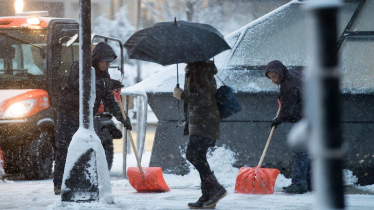
What Boston forecasters are saying about the impact, timing, and snow totals of Tuesday’s winter weather
"Slick travel all day long."
Related Links
National Weather Service: “Take precautions this morning and prepare for reduced visibility & icy roads on your AM commute.”
[530 am] Take precautions this morning and prepare for reduced visibility & icy roads on your AM commute. Changeover to wintry mix/rain is expected south of MA turnpike. Moderate ice accretion possible in CT/RI. An arctic blast comes Wed night/Thu. pic.twitter.com/7J9N1ZUq3b
— NWS Boston (@NWSBoston) December 17, 2019
[Snow/Ice Line] The Correlation Coefficient (CC) radar product is showing the snow/ice changeover line moving slowly N from the ocean. The leading edge of yellow colors (lower values) depicts this line. Snow will change to sleet/freezing rain along RI coast and islands 4-5 am. pic.twitter.com/COb241lIVR
— NWS Boston (@NWSBoston) December 17, 2019
Many different #winter precip types Tue. Why? Warm air aloft b/w 5-9 kft initially but gets deeper during the day. #Snow to start but then partially melts aloft & refreeze into #sleet/#ice pellets upon entering colder air below. Warm air deepens but rain freezes on contact. #MA pic.twitter.com/x4BbPywEGF
— NWS Boston (@NWSBoston) December 16, 2019
Dave Epstein: “Burst of snow, goes over to mix and then back to some lighter snow this evening.”
Pulled up the Albany radar to show you what’s coming post 9 a.m. Steadier precipitation, probably in the form of sleet and freezing rain south of the Pike and snow and sleet North. pic.twitter.com/CGXoexQoRj
— Dave Epstein (@growingwisdom) December 17, 2019
Sleet back to the west and south. pic.twitter.com/odm1jJFxxi
— Dave Epstein (@growingwisdom) December 17, 2019
Shifted everything north this morning. Less snow impact, but still sleet/fr rain and then back to snow later this evening before ending. pic.twitter.com/I6GC0I1KG9
— Dave Epstein (@growingwisdom) December 17, 2019
A bit slower start means early commute is ok into Boston. Burst of snow, goes over to mix and then back to some lighter snow this evening. Treated surfaces ok all day. Untreated will be slick. Slower travel, but not high impact. pic.twitter.com/jSqGJmRJDP
— Dave Epstein (@growingwisdom) December 17, 2019
Terry Eliasen, WBZ: “Intensity of snowfall will come in waves, lighter at times and steady/heavy at times.”
Snow changes to sleet and rain this afternoon and then later tonight BACK to light snow…so while snow amounts won’t be that dramatic with this storm, we will continue to be impacted through tonight pic.twitter.com/gZfAA9aVTN
— Terry Eliasen (@TerryWBZ) December 17, 2019
If you are currently looking outside and wondering where the snow is…you are likely in one of these snow holes…it will fill in as morning goes along…patience! pic.twitter.com/OmXtaqwVCA
— Terry Eliasen (@TerryWBZ) December 17, 2019
The best shot of accumulating snow is right here…an hour or two away…this will be majority of accumulation for areas north of Pike from about 9a through midday pic.twitter.com/1V7BgdAJGu
— Terry Eliasen (@TerryWBZ) December 17, 2019
Likely will be mainly on the lower end of these forecast numbers in general…only have about 3-6 hours for snow to accumulate before mixing pic.twitter.com/inIqZJDP4M
— Terry Eliasen (@TerryWBZ) December 17, 2019
By this afternoon, the snow will be confined to NH and VT…lots of sleet inland and rain at the Coast pic.twitter.com/i3GvYNv8fA
— Terry Eliasen (@TerryWBZ) December 17, 2019
Intensity of snowfall will come in waves, lighter at times and steady/heavy at times pic.twitter.com/COrTYDD8ZV
— Terry Eliasen (@TerryWBZ) December 17, 2019
Cindy Fitzgibbon, WCVB: “Slick travel all day long.”
Icing is a concern today… it just takes a small amount to make things very slippery. A glaze to up to a tenth of an incg of ice possible along and south of the pike including the Worcester area. #wcvb pic.twitter.com/AEN88rbxdo
— Cindy Fitzgibbon (@Met_CindyFitz) December 17, 2019
Snow is filling in this morning but will mix with sleet and freezing rain by midday. Icy inland this afternoon with rain along the coast. Slick travel throughout the day #wcvb pic.twitter.com/TwH4Wq00Uu
— Cindy Fitzgibbon (@Met_CindyFitz) December 17, 2019
Good Tuesday morning! Snow is just starting and will fill in during the morning commute. A change to sleet, freezing rain and rain is expected by midday for many. Slick travel all day long. Turn on #wcvb for timeline and forecast details pic.twitter.com/Si9oSajwHH
— Cindy Fitzgibbon (@Met_CindyFitz) December 17, 2019
Chris Lambert, WHDH: “Mix with sleet/freezing rain is widespread inland south of Rte. 2 by Noon. Rain in Boston by then.”
Mix line working south to north. Freezing rain and sleet will be an issue today, especially west of I-95 pic.twitter.com/Tep4cpgMcA
— Chris Lambert (@clamberton7) December 17, 2019
Sleet (ice pellets that bounce of everything) most prolonged north of the Pike this afternoon. Southern NH is mostly snow. pic.twitter.com/5nLzZSesI4
— Chris Lambert (@clamberton7) December 17, 2019
Freezing rain (drops that freeze on contact) will be most widespread from Southern Worcester County, into RI and CT through the day. pic.twitter.com/dwOfMmuyKU
— Chris Lambert (@clamberton7) December 17, 2019
Near or above freezing along I-95 by noon. West of there, sleet and freezing rain with icy untreated surfaces will be an issue. pic.twitter.com/ei0lFt8Gek
— Chris Lambert (@clamberton7) December 17, 2019
Snow to ice to rain for some. Messy mix this Tuesday pic.twitter.com/fYRK5LDyY7
— Chris Lambert (@clamberton7) December 17, 2019
Mix with sleet/freezing rain is widespread inland south of Rte. 2 by Noon. Rain in Boston by then. pic.twitter.com/59ADzbdvoq
— Chris Lambert (@clamberton7) December 17, 2019
Updated snow map… Along and south of Pike, a couple inches or less before the flip to ice/rain. Highest snow totals near MA/NH border. pic.twitter.com/FiKqbo5D5L
— Chris Lambert (@clamberton7) December 17, 2019
Shiri Spear, Boston 25 News: “This storm won’t be a huge snow-maker but you need to be careful for a layer of ice on top. Roads may turn icy today in your town.”
https://twitter.com/ShiriSpear/status/1206895874078597120
Snow to start in #Boston today then a wintry mix by lunchtime. We’ll see some rain & freezing rain this afternoon in the region too. @boston25 pic.twitter.com/r79flVSrIK
— Shiri Spear (@ShiriSpear) December 17, 2019
The Winter Weather Advisory will last longest inland where we see more snow & ice. Be safe! @boston25 pic.twitter.com/9UhY65o5xa
— Shiri Spear (@ShiriSpear) December 17, 2019
This storm won’t be a huge snow-maker but you need to be careful for a layer of ice on top. Roads may turn icy today in your town. @boston25 pic.twitter.com/KG1ZrbD44u
— Shiri Spear (@ShiriSpear) December 17, 2019


To comment, please create a screen name in your profile
To comment, please verify your email address
Conversation
This discussion has ended. Please join elsewhere on Boston.com