What forecasters are saying about the ‘persistent’ storm that is ‘lingering’ over New England
"It's a very slow commute.”
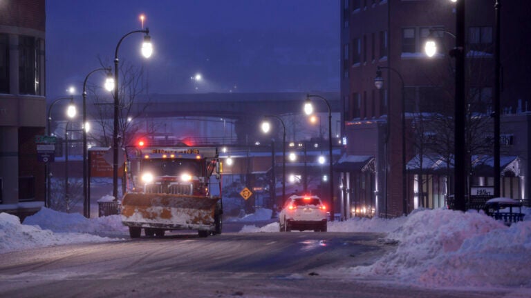
The end is in sight.
Forecasters with the National Weather Service said Tuesday morning that the “persistent winter storm” that has been “lingering” near New England since it began impacting the region on Sunday will finally depart into the Gulf of Maine by the afternoon. But not before it brings one more round of precipitation to Massachusetts.
“Precipitation has been very banded so far this morning,” the service wrote. “It can go from snowing up to 2 [inches] per hour, then 10 miles away not much. Band across central MA into northern CT had visibilities as low as one quarter mile at times, which will make for treacherous travel. Elsewhere, snow was falling more lightly with visibility generally 2-4 miles.”
According to the service, snow totals so far ranged from just over 2 inches at Boston’s Logan Airport to about a foot at Worcester’s airport.
Snowstorm totals through midnight 12/3:
T F Green Airport, Warwick RI 2.1 inches
Logan Airport, Boston MA 2.3 inches
NWS Boston/Norton, 3.9 inches
Worcester Airport, Worcester MA 12.4 inches
Bradley Airport, Windsor Locks CT 13.4 inches— NWS Boston (@NWSBoston) December 3, 2019
Forecasters warned commuters to watch out for poor driving conditions through mid-morning.
A band of snow is shifting southeast…and extends from Haverhill MA, MetroWest, and into NE CT & NW RI. This area of snow produced heavy snowfall rates in Western New England overnight. If you are in the affected area, be ready for poor driving conditions through mid morning. pic.twitter.com/wy5q5hTaQ1
— NWS Boston (@NWSBoston) December 3, 2019
[6:30 am] latest radar indicating heaviest #snow on the south coast of #MA from Westport to Darmouth to New Bedford with hourly snowfall rates of 1-2″ per hour! However back edge of the snow has already cleared much of #CT and western MA. pic.twitter.com/xiFLZnEvhu
— NWS Boston (@NWSBoston) December 3, 2019
“Allow extra time to reach your destination this morning, it’s a very slow commute,” service meteorologists wrote. “Snow will end as the morning progresses from west to east. By noon snow should be confined to eastern coastal [Massachusetts] including Boston & Cape Cod.”
[6:35 am] #Snow becoming heavy again in #Boston. Allow extra time to reach your destination this morning, it’s a very slow commute. Snow will end as the the morning progresses from west to east. By noon snow should be confined to eastern coastal #MA including Boston & Cape Cod pic.twitter.com/YJATXsfKmG
— NWS Boston (@NWSBoston) December 3, 2019
Below, what other local meteorologists are saying about the final day of the winter storm.
Dave Epstein:
Snow will linger this morning. Will be watching radar trends as storm continues to undergo development. Snow has been very banded. Meaning it goes from heavy to light quickly/over short distances. Low confidence higher snow Essex to coastal Norfolk/Plymouth Counties. pic.twitter.com/UdUoDU4PFD
— Dave Epstein (@growingwisdom) December 3, 2019
Moderate to heavy bands of snow continue to rotate South. This is going to be with us for the morning folks especially east of 495. pic.twitter.com/QCH9ObCYdZ
— Dave Epstein (@growingwisdom) December 3, 2019
If you don’t like shoveling multiple times, wait a while. Noon radar projection from one model still saying it’s snowing in eastern areas. pic.twitter.com/Rkkr8oSiBP
— Dave Epstein (@growingwisdom) December 3, 2019
Shiri Spear, Boston 25 News:
Looking ahead, here’s what we see for additional snow. I’ll update this throughout the morning as heavy bands shift eastward! @boston25 pic.twitter.com/20YBJ9auo2
— Shiri Spear (@ShiriSpear) December 3, 2019
Highest reports so far are across western/northern MA & southern NH. Send us your TOTAL report (from the middle of the yard please!) @JBrewerBoston25 @boston25 pic.twitter.com/YWBcf2M6aU
— Shiri Spear (@ShiriSpear) December 3, 2019
Sarah Wroblewski, WBZ:
Snow intensity picking up in spots… heavy snow will quickly reduce visibility with snowfall rates up to 2″ an hour. Snow will quickly cover roads and create slippery conditions. #WBZ pic.twitter.com/WW9XMvvKEl
— Sarah Wroblewski (@sarahwroblewski) December 3, 2019
Intense snowfall reducing visibility… you can see many areas in metrowest to central MA into NW RI & NE CT are under a heavy band of snow leading to visibility issues. #WBZ #WBZThisMorning pic.twitter.com/1ARi7rtW7q
— Sarah Wroblewski (@sarahwroblewski) December 3, 2019
Gusty conditions this morning… gusts up to 50 mph possible over the Cape & Islands where a WIND ADVISORY is in place. #WBZ pic.twitter.com/NHeCLpaMcZ
— Sarah Wroblewski (@sarahwroblewski) December 3, 2019
Michael Page, NBC10 Boston & NECN:
Good Morning! The final burst of snow is here now! Snowy drive to school and work, but big improvements by afternoon. We’re live on @NECN & @NBC10Boston through 7 AM. pic.twitter.com/ER2nhNt3RW
— Michael Page (@MichaelPageWx) December 3, 2019
5:40 AM | Heaviest snow right Boston down into Southeastern Massachusetts. If you can delay your commute by even just 2 hours, conditions will greatly improve. Still snows after that, but much lighter and easier for crews to clean up. More on @NECN & @NBC10Boston pic.twitter.com/G26OzQTkbf
— Michael Page (@MichaelPageWx) December 3, 2019
Cindy Fitzgibbon, WCVB:
Good Tuesday morning! Waking up to bands of heavier snow which will linger in eastern MA thru 9am. *Slick for AM Commute* Snow ends by noon with some late day breaks of sun developing. Turn on #wcvb for forecast details pic.twitter.com/B6AM5KfTMb
— Cindy Fitzgibbon (@Met_CindyFitz) December 3, 2019
Heaviest band of snow just after 6am down along the south coast- heavy snow Fall River area to New Bedford. Bands of heavy snow at times linger thru 9am #wcvb pic.twitter.com/dB9k5xdVxk
— Cindy Fitzgibbon (@Met_CindyFitz) December 3, 2019
Waking up to more snow – the final round of this storm that started on Sunday afternoon bringing up to 6″ of new snow. Tapers off around noon #wcvb pic.twitter.com/uGmWbNzmaF
— Cindy Fitzgibbon (@Met_CindyFitz) December 3, 2019
Chris Lambert, WHDH:
Got snow? Send us your report. Some big totals coming out of northern Worcester and northwest Middlesex County. pic.twitter.com/bKFPeVcWJV
— Chris Lambert (@clamberton7) December 3, 2019
Slick travel through the morning commute as bursts of heavier snow reduce visibility and cover the roads. pic.twitter.com/HtWFvFNLHR
— Chris Lambert (@clamberton7) December 3, 2019
https://twitter.com/clamberton7/status/1201826393488809984


To comment, please create a screen name in your profile
To comment, please verify your email address
Conversation
This discussion has ended. Please join elsewhere on Boston.com