Maps: Here are the snow totals across Massachusetts
“Intensity of snow is beginning to diminish."
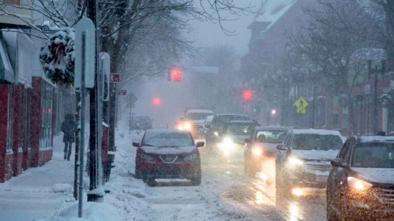
The snow is still falling, but forecasters say the precipitation from the “lingering” winter storm will taper off by Tuesday afternoon.The storm, which began impacting Massachusetts on Sunday, had already dumped more than a foot of snow on parts of the state by Tuesday, with several hours of heavy snowfall reducing visibility and causing difficult conditions for the morning commute.
“Intensity of snow is beginning to diminish,” service forecasters wrote just before noon. “This trend will continue with snow tapering off and ending this afternoon.”
[Radar update – 11 am] Intensity of snow is beginning to diminish. This trend will continue with snow tapering off and ending this afternoon. pic.twitter.com/Vak2PzaUOs
— NWS Boston (@NWSBoston) December 3, 2019
[Radar update – 130 pm] The last of the snow bands are rotating through eastern MA. Up to an additional one half inch is possible before the snow ends around mid afternoon. pic.twitter.com/SFukwwxraa
— NWS Boston (@NWSBoston) December 3, 2019
[250 PM] One last band of snow rotating across portions of the eastern MA coast late this afternoon, which may cover roadways. Also, roads that are currently wet may see patches of ice develop too with sunset approaching. Keep this in mind for the afternoon commute. pic.twitter.com/z3Ao5f0eGK
— NWS Boston (@NWSBoston) December 3, 2019
The National Weather Service estimated the eastern part of the state had seen between 2 and 8 inches of accumulation by Tuesday morning, while the central and western parts of Massachusetts had observed higher totals stretching above 2 feet in Winchendon.
Below, reports from local meteorologists on how much snow had been observed across the state as of Tuesday.
National Weather Service

Dave Epstein
Some snow totals so far since Sunday. I under forecasted today’s totals. Snow lingers several more hours. pic.twitter.com/GY1UEAbCvG
— Dave Epstein (@growingwisdom) December 3, 2019
WBZ
3 day totals…
WINCHENDON 25.0
ROYALSTON 25.0
FITCHBURG 22.0
STERLING 20.0
LUNENBURG 17.1
GARDNER 17.0
LEOMINSTER 15.4
HOLDEN 15.0
WORCESTER 13.5— Terry Eliasen (@TerryWBZ) December 3, 2019
3 day totals…
PEPPERELL 16.2
WILMINGTON 13.4
BURLINGTON 13.1
HOPKINTON 12.5— Terry Eliasen (@TerryWBZ) December 3, 2019
3 day totals…
WALPOLE 9.0
WEYMOUTH 5.1
STOUGHTON 5.0
BROCKTON 8.3
ROCKLAND 5.8— Terry Eliasen (@TerryWBZ) December 3, 2019
3 day leader right now appears to be….drum roll…
Winchendon, MA: 25.0″— Terry Eliasen (@TerryWBZ) December 3, 2019
More 3 day totals…
Cambridge, MA: 6.3″
Byfield, MA: 6.0″
New Bedford, MA: 5.8″
Weymouth, MA: 5.1″
West Warwick, RI: 5.0″
Swansea, MA: 5.0″
Hanover, MA: 4.0″
Acushnet, MA: 3.3″
Middleboro, MA: 3.2″
Fairhaven, MA – Pope Beach: 2.4″— Terry Eliasen (@TerryWBZ) December 3, 2019
WCVB
Most of these numbers are recent, but there are a few that are from early this AM. Updates to follow! Please keep in mind, these reports are all thanks to public and trained NWS spotters. Very thankful for all the people who take the time to measure! #wcvb pic.twitter.com/LLCT5VkDXZ
— Kelly Ann Cicalese (@kellyannwx) December 3, 2019
Boston 25 News
Totals keep inching upward. So far since Sunday…@boston25 pic.twitter.com/MvdBuA8vjY
— Jason Brewer (@JasonNBrewer) December 3, 2019


To comment, please create a screen name in your profile
To comment, please verify your email address
Conversation
This discussion has ended. Please join elsewhere on Boston.com