‘Still spinning’: Here’s the latest on what to expect from the ongoing nor’easter
Local meteorologists still have plenty to say about the "long duration offshore ocean storm."
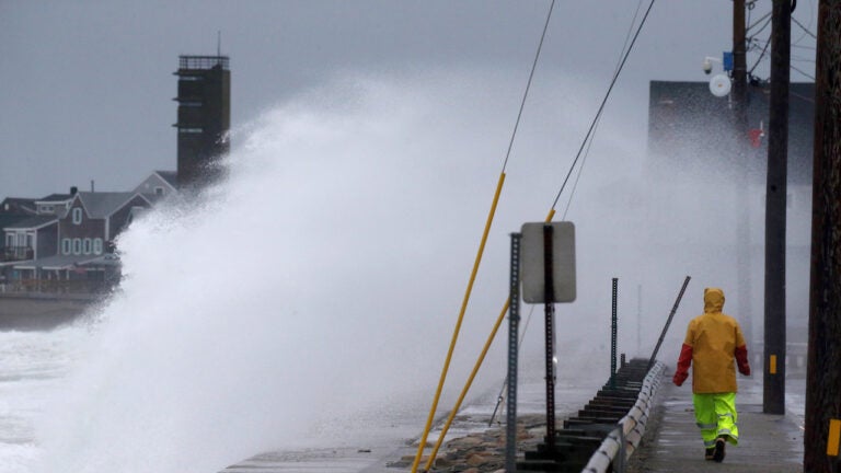
On the third day of a nor’easter, the storm is set to continue to bring wind, rain and potential coastal flooding, particularly for Cape Cod and the Islands, and Nantucket.The National Weather Service predicted Friday morning that the “long duration offshore ocean storm” will continue to produce sustained winds at a maximum of 25 to 35 miles per hour along the coastlines of the Cape and Islands with maximum gusts between 35 and 50 miles per hour. The strongest winds are predicted for Friday morning and afternoon; they’re supposed to die down Friday evening.For Boston, maximum wind gusts could reach between 35 and 40 miles per hour through Friday afternoon, the service said.
Strong NE winds will continue to be the biggest issue today mainly along the immediate coastline. Lesser impacts as you get just a few miles inland. Gusts up to 50 mph for #Nantucket. pic.twitter.com/Uvqy2H8f9T
— NWS Boston (@NWSBoston) October 11, 2019
“Our nor’easter is still spinning well to our south…gusty winds and rough season continue today,” Terry Eliasen, a meteorologist with WBZ, said.
Our long duration offshore ocean storm will continue to bring wind, rain and coastal flooding to southern New England as well as hazardous boating conditions for mariners today into tonight.
The full details below. pic.twitter.com/2s74FZlVQ6
— NWS Boston (@NWSBoston) October 11, 2019
Our nor’easter is still spinning well to our south…gusty winds and rough season continue today
— Terry Eliasen (@TerryWBZ) October 11, 2019
[6a] At this hour, pretty good wind (left) & wave (right) activity ongoing. Rough going along the coast. Welcome any and all reports. pic.twitter.com/bMDaDECX91
— NWS Boston (@NWSBoston) October 11, 2019
The storm could also bring some minor coastal flooding to Nantucket with 1.5-to-2-foot storm surge during high tides with waves reaching 5 to 10 feet, the service said. Nantucket was under a coastal flood advisory as of 6:15 a.m. Friday.
“Expected inundation of less than one-foot above ground level in low-lying areas near shorelines,” the service said.
Monitoring surge as we approach high tide. Presently a near 2.2 ft surge at #Nantucket. High tide @ 11:30 am.
COASTAL FLOOD ADVISORY for #Nantucket. Expected inundation of less than one-foot above ground level in low-lying areas near shorelines. Potential issues for Easy St. pic.twitter.com/3UfpYYveY7
— NWS Boston (@NWSBoston) October 11, 2019
The service also predicts “dangerous sea conditions for all vessels” with strong winds and “high seas” off shore.
Since Wednesday, Boston has received just .1 inches of rain, but areas of Cape Cod have gotten well over an inch. Nantucket has received nearly 3 1/2 inches of rain, the service said.
[Observed Rainfall Totals] How much rain have you received since Wednesday? Reports below from our spotters across #MA #RI #CT pic.twitter.com/M8n9P5p5XP
— NWS Boston (@NWSBoston) October 11, 2019
“Bands of showers, mostly light, will expand farther north and west of Boston today then weaken and ease out of the picture tomorrow morning,” WBZ meteorologist Barry Burbank said.
Bands of Showers, Mostly Light, Will Expand Farther North & West Of Boston Today Then Weaken & Ease Out Of The Picture Tomorrow Morning. Sunday & Monday Will Be Brighter & Nicer! #holiday weekend #wbz pic.twitter.com/tLft6cceQ6
— Barry Burbank (@BarryWBZ) October 11, 2019
He predicts Boston could get another .3 inches of rain before midnight Friday.
Projected Rainfall From Later This Morning To Midnight… Unlike The Last Day Or 2, Some Showers Should Penetrate Farther North & West Of Boston Today. #wbz pic.twitter.com/DWu4FJi5Og
— Barry Burbank (@BarryWBZ) October 11, 2019