7 maps predicting how much snow will fall in Massachusetts Tuesday into Wednesday
“The afternoon into evening commute is going to be a mess.”
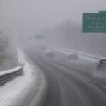
Meteorologists are warning that the commute home on Tuesday is not going to be an easy one.
Related Links
Forecasters say a winter storm will bring snow that will change to ice and rain impacting evening travel.
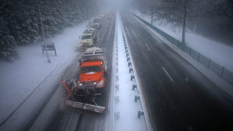
“The afternoon into evening commute is going to be a mess,” the National Weather Service said Tuesday on Facebook. “If you can, please stay off the roads. This will be a high-impact event [with] slowed commutes, long drive homes, slick roads as moderate to heavy snow/sleet impacts the area.”
The precipitation is expected to start in Boston around 1 p.m. Tuesday and end at roughly 5 a.m. Wednesday. The service has issued Winter Storm Warnings and Winter Weather Advisories for Massachusetts during that time.
Winter storm warnings & advisories posted. Significant impacts for today’s afternoon into evening commute. If you can, stay home, stay off the roads, today is going to be a mess as moderate to heavy snow / sleet of @ 1″/hr hits our area beginning @ noon. pic.twitter.com/pkF4h2Y1mQ
— NWS Boston (@NWSBoston) February 12, 2019
Below, seven maps from local meteorologists predicting how much snow will fall in Massachusetts.
National Weather Service

David Epstein
3-6 inches of snow for the most populated areas of Massachusetts. More north and less south. Remember ultimately bands can end up slightly 10-15 miles further south or north. pic.twitter.com/sm5rjcOuFe
— Dave Epstein (@growingwisdom) February 12, 2019
WBZ
Here are the details for today’s snow #WBZ #Boston pic.twitter.com/zdxhqBBDQq
— Kate Merrill (@KateMerrill) February 12, 2019
WCVB
Snow going to come in hard 1-3pm and it will snow heavily thru the evening commute. 4-6″ for many of us before a change to sleet and rain. A sloppy, slushy waterlogged mess by tomorrow AM as the storm moves out #wcvb pic.twitter.com/2hqT0mWVau
— Cindy Fitzgibbon (@Met_CindyFitz) February 12, 2019
7News
Snow map time… Most of this falls between 3-7pm. Thinking about 4″ in Boston, 4-5″ Worcester, widespread 4-6″ north of the Pike and widespread 3-4″ south. Then sleet to rain this evening/overnight. pic.twitter.com/9yfVVC6caA
— Chris Lambert (@clamberton7) February 12, 2019
Boston 25 News
SNOW MAP: This sticks in the afternoon & evening before flipping to sleet, freezing rain then rain. #mawx #nhwx @boston25 pic.twitter.com/GioLSmUVzl
— Shiri Spear (@ShiriSpear) February 12, 2019
NBC10 Boston
Here’s the forecast snow accumulation map we’re airing this morning on @nbc10boston (as usual, we’ll cover all of New England on @necn starting at 7AM but remain focused on Boston area on Channel 10). Tune in for our built-in-house NBC model showing our take on timing. pic.twitter.com/3ccCV8O2VL
— 1DegreeOutside (@1DegreeOutside) February 12, 2019