Here’s what local meteorologists are saying about the potential snowstorm Wednesday
The National Weather Service says it's "confident" New England will see the effects of a fourth nor'easter this month. And there might be a fifth.
Related Links
It looks like the groundhog was right.
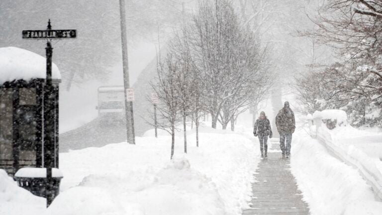
Despite what the calendar says, the winter weather isn’t quite over. In addition to unseasonably cold temperatures, local meteorologists are forecasting that the month’s fourth — and a potential fifth — nor’easter will hit New England within the next week.
The National Weather Service said Sunday afternoon that it’s “confident” a coastal storm will impact New England late Wednesday into Thursday, though the exact magnitude and breadth of the system remains uncertain.
Folks, monitoring a potential Wednesday → Thursday #NorEaster; low confidence forecast presently; evaluating possible threats & impacts of accumulating snow & strong NE winds … also some coastal flood issues around a early Thurs AM high tide; stay informed to later forecasts pic.twitter.com/OUGwaE6e74
— NWS Boston (@NWSBoston) March 18, 2018
“There’s still a lot to see with how this storm moves, but our current thoughts are that Boston and areas to the south of it could see some snow,” NWS meteorologist Kim Buttrick told The Boston Globe, putting the possibility of accumulation in the Boston area at 30 percent.
Forecasters for the service said Monday morning that temperatures Wednesday will be borderline for snow accumulation. However, their latest projections showed potential snowfall of 4 to 5 inches in southeastern Massachusetts, with diminishing amounts toward the northwestern part of the state.
NBC Boston meteorologist Michael Page said Monday that it’s a “good bet” that most of the Boston area could get at least 3 inches.
Don’t have enough confidence in our mid-week storm to stick numbers on a map just yet, so I opted for this route. 3″+ a good bet for most of the Boston area. More details on @NECN & @NBC10Boston until 9 AM pic.twitter.com/GXy0xFl2xD
— Michael Page (@MichaelPageWx) March 19, 2018
Flooding is also a concern for coastal Massachusetts due to high astronomical tides and wind.
We continue to monitor storm for Wed/Thur. Still uncertainty on details, but at this time, potential for:
· Plowable #MAsnow, particularly eastern MA
· Strong winds (up to 45-55 mph), particularly SE MA
· Coastal flood impacts along eastern MA coastline at Thur AM high tide pic.twitter.com/rmaocKQdwR— MEMA (@MassEMA) March 19, 2018
Meteorologists have been tracking the storm since last week’s nor’easter, which resulted in heavy snow and roughly 160,000 power outages across the state. According to WBZ’s Eric Fisher, this week’s storm doesn’t look as intense, but the system and accompanying cold temperatures could conspire to result in snow. Fisher added Monday morning that the overnight forecast showed only increasing odds of plowable snow Wednesday.
Not as intense as the last few nor’easters but looking plenty close and cold enough to bring snow to the area on Wednesday pic.twitter.com/jOfSP00EV8
— Eric Fisher (@ericfisher) March 18, 2018
Plowable snow odds continue to go up with the overnight Euro (for Wednesday). Just can’t shake winter. pic.twitter.com/5oYrfLNyNW
— Eric Fisher (@ericfisher) March 19, 2018
Forecasters said Sunday afternoon that the latest models had shifted, making a potential storm more likely to occur than previously predicted.
“This would mean some snow in eastern MA, generally light,” WCVB meteorologist Mike Wankum tweeted. “We’ll have to monitor this shift to see if it’s a new trend.”
Latest European Model now wants to jog the storm back closer to the coast on Wed. This would mean some snow in eastern MA, generally light. We’ll have to monitor this shift to see if it’s a new trend. Euro had been advertising a miss the last 2 days. #wcvb pic.twitter.com/TtyGyb9SFg
— Mike Wankum (@MetMikeWCVB) March 18, 2018
Chances of precipitation increase – could this be a trend? It’s possible that areas hardest hit during Nor’easter #3, get another round of accumulating snow Wednesday! @NBC10Boston @NECN pic.twitter.com/eSiznCPbWr
— Chris Gloninger, CCM, CBM (@ChrisGloninger) March 18, 2018
A little movement north in the models… still most keep the bulk of this storm offshore WED-THU… but highest threat is across the SE for snow/wind impacts. #Boston25 #StillNeedToWatch pic.twitter.com/XOFW56xK1o
— Sarah Wroblewski (@sarahwroblewski) March 18, 2018
In addition, there is also the possibility of a fifth March nor’easter toward the end of next weekend, forecasters said.
Don’t even get me started on the possibility of a 5th nor’easter end of next weekend. #ICantEven #worstmonth pic.twitter.com/AdC6PhmtZY
— Eric Fisher (@ericfisher) March 18, 2018
Come on…Working on my 7-day forecast & well… #NextSunday #NotSetInStone #Uncle #WhereIsSpring #NotAgain #NorEaster #Boston25 pic.twitter.com/wIujPjcyQB
— Sarah Wroblewski (@sarahwroblewski) March 18, 2018
#4 is back in the cards… and so is #5… 🏳️ #ISurrender pic.twitter.com/tVW97bNCe5
— Chris Gloninger, CCM, CBM (@ChrisGloninger) March 18, 2018
NBC Boston meteorologist Chris Gloninger isn’t the only one waving the white flag on this winter. But as Gloninger also noted, as rough as March has been, it doesn’t take a particularly long memory to know that things could be worse.
https://twitter.com/ChrisGNBCBoston/status/975462965192331264


