7 maps predicting how much it’ll snow Wednesday into Thursday in Massachusetts
National Weather Service forecasters say the uncertainty for the snow forecast for the I-95 corridor remains “high.”
Related Links
Get the latest weather alerts sent directly to your phone. Download the Boston.com mobile app on your Apple or Android device.
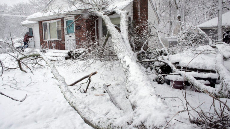
The National Weather Service issued a Winter Storm Warning for inland Massachusetts for Wednesday into Thursday, which it expanded Wednesday afternoon to include the Boston metro area. “A major winter storm today into early Thursday will bring heavy, wet snow and the potential for power outages across interior southern New England,” the service said. “Mainly heavy rain and strong winds will occur along and southeast of the Boston to Providence corridor, with the potential for some renewed river/stream flooding.” Service forecasters said Wednesday afternoon that the snow forecast for the I-95 corridor remained uncertain, even as totals were “nudged upward” from initial predictions. “Keep in mind uncertainty remains HIGH in the outlined area, since surface temperatures will be key to accumulating snow or melting,” the service said of the I-95 corridor. “In these areas, especially in the cities, slushy accumulations are expected on roads, with most accumulations on grass.”Most of the storm’s accumulation is expected to take place between 6 p.m. and midnight, according to the service.
Here’s how the storm should unfold in SNE: Heavy snow inland, rain changing to snow in RI/E MA this evening, heavy at times thru midnight. It all winds down Thu AM. pic.twitter.com/Yrm0qRkhbd
— NWS Boston (@NWSBoston) March 7, 2018
Meteorologist David Epstein has a full breakdown of the storm, but here are seven maps predicting how much snow will fall:
National Weather Service:

David Epstein:
With track further east of the storm, snow totals increase over eastern areas. These numbers are on grass, pavement may/will be less. pic.twitter.com/JGEAMdbWw8
— Dave Epstein (@growingwisdom) March 7, 2018
CBS Boston:
UPDATE: Looks like more snow will fall in around the 495 belt (via @TerryWBZ ) https://t.co/7LmNI31dON pic.twitter.com/8S3MdMfkr5
— WBZ | CBS News Boston (@wbz) March 7, 2018
WCVB:
Mainly rain for a lot of SE MA…and heavy snow I-495 N&W. In between a mix of both. Expecting 2-4″ in Boston… but the amounts ramp up quickly as you go just a few miles west. Breaking down the timeline, the wind and coastal concerns on #wcvb until 7am pic.twitter.com/fV8ogRMT2V
— Cindy Fitzgibbon (@Met_CindyFitz) March 7, 2018
7News Boston:
Snow totals have been nudged up in some areas and the winter storm warning has been expanded to cover Boston. Latest forecast here: https://t.co/oUiCfnNvSY #7News pic.twitter.com/NItToDs4PH
— 7News Boston WHDH (@7News) March 7, 2018
Boston 25 News:
Remember to check back with me, @sarahwroblewski & @JBrewerBoston25 through the day… 20 miles is the difference between 2″ snow and 12″ snow-any slight shift could have a BIG impact on snow totals in your town.@boston25 #mawx #nhwx pic.twitter.com/83HP5P7pC2
— Shiri Spear (@ShiriSpear) March 7, 2018
NBC10 Boston:
Here’s the latest expected snowfall range. Stay with @NBC10Boston for updates pic.twitter.com/e0D6SWSi6g
— Nick Emmons (@NickEmmonsTV) March 7, 2018