New Year’s Eve forecast: The sun returns, but so does the cold
Temperatures will drop into the low 30s for First Night festivities.
Back in the early 1960s when weather satellites were launched, they afforded meteorologists a great opportunity to actually see how clouds were moving across the globe. More than 60 years later, we continue to rely on satellites as one of the primary weather tools, especially for short-term forecasting.
The satellite loop Friday morning showed clouds socked in across all of New England. There has been a dearth of sunshine this week, and we’re really going to have to wait until Sunday, New Year’s Eve, for it to return.

Some spotty showers or drizzle activity are possible through Saturday, along with temperatures not changing much between the day and the night.
When you have thick clouds like this, it doesn’t allow the solar radiation during the day to have much of an impact, so temperatures don’t change a lot.

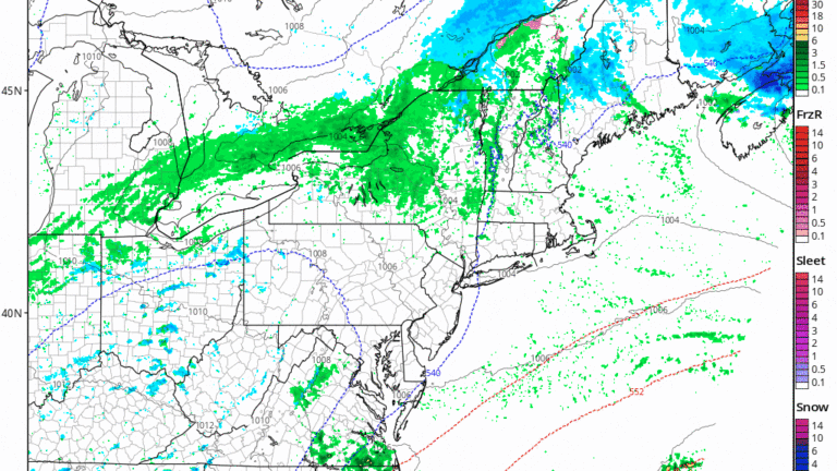
The predictive radar loop above indicates a few areas of precipitation crossing the region through Saturday, but drier air and a new air mass will arrive on Sunday.

Temperatures will be in the 40s Saturday afternoon — a little bit above average for this time of year. With the clearing taking place Saturday night, readings will fall at or a little below freezing. I suppose there could be a few minor slick spots Sunday morning with readings at sunrise under 30 degrees for most of the area.
The rest of Sunday looks bright and dry followed by a clear beginning to 2024. Expect temperatures within a few degrees of 30 as 2024 begins.


The first half of the upcoming week and the start of the new year look dry. Our El Niño winter continues along with a stronger than average subtropical jet stream.
The loop below shows how this jet stream continues to meander from California across Texas and into Florida. The warmer colors are indicative of higher wind. When you have a subtropical jet that is the dominant feature this far south, it tends to bring storminess from the Pacific into California and then it continues eastward. This type of pattern also doesn’t allow deep cold air into the United States.

We are unlikely to see any appreciable snowfall in the first week of the month, but there are a few small signs that the second week of January may bring the opportunity for some significant snowfall in parts of New England. Whether or not this ends up at the coastline or in the mountains is, of course, speculation. I will be watching the trends as we begin the new year.


To comment, please create a screen name in your profile
To comment, please verify your email address
Conversation
This discussion has ended. Please join elsewhere on Boston.com