All the places that wouldn’t exist if Back Bay still looked like this historical photo
The filling in of wetlands along the Charles River in the 19th century transformed Boston.
As its name implies, Boston’s Back Bay neighborhood was not originally a neighborhood at all – it was wetlands.
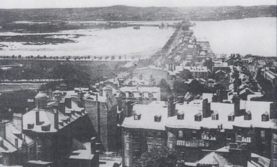
This pre-1858 view of the city, which surfaced on Reddit, is taken from the Massachusetts State House. You can see along the Mill Dam road, an extension of Beacon Street separating the Back Bay on the left and the Charles River on the right.
According to the Neighborhood Association of the Back Bay, the city began filling in the land around Beacon Street in 1857 and eventually made 450 acres of useable land. Filling lasted until around 1900.

Now Back Bay is home to beautiful brownstone apartments and has even been called a “work of art.’’
The median value of a home in Back Bay’s 02116, an almost entirely man-made zip code, is just under $900,000, according to Zillow. That easily puts the value of property in the nieghborhood in the billions of dollars, even without including the Prudential Center, which holds an assessed value of more than $400 million.

This overlay of an 1806 map onto modern Boston gives a sense of just how much the city owes to landfill projects. You can see an interactive, citywide version here.
A few other famous buildings that sit on former wetlands?
The Boston Public Library
[fragment number=0]
Trinity Church
[fragment number=1]
The Old South Church
[fragment number=2]
The Mandarin Oriental Hotel
[fragment number=3]


To comment, please create a screen name in your profile
To comment, please verify your email address
Conversation
This discussion has ended. Please join elsewhere on Boston.com