Drones used during response to Vermont’s Amtrak derailment
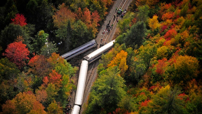
Two hours after an Amtrak train derailed in Vermont on October 5, drones from the University of Vermont’s disaster response team were in the air over the crash site.
Authorities needed to pictures of the site to guide their response to the crash, and within an hour, the drones took 280 images that were geo-located to the scene, according to a Slate report.
By the end of the day, the university’s Spatial Analysis Lab, which operated the dones, put together a map of the crash site for investigators.
Jarlath O’Neill-Dunne, director of the Spatial Analysis Lab, told Slate he first became interested in using drones to respond to, and document, disasters in 2011 when Hurricane Irene caused destruction in Vermont.
Satellites were available for use, but O’Neill-Dunne said they proved ineffective due to cloud coverage and timeliness.
Read the full Slate report here.


To comment, please create a screen name in your profile
To comment, please verify your email address
Conversation
This discussion has ended. Please join elsewhere on Boston.com