Google Maps ‘As The Crow Flies’
Google will now let you fly as the crow does.
According to The Atlantic City Lab:
“Google Maps this week has updated with a fresh tool. Users can right-click on any location on a map, select ‘measure distance,’ click on another location, and see a line displaying the exact mileage between the two points.’’
This can be helpful if you are flying a plane, wanting to know the distance you have run or walked, or, sadly, how far out of your way public transportation takes you.
T route going from Boston University area to Harvard Square via the B Green Line and the Red Line toward Alewife. (Yes, there is a bus that is a faster route) It is a little over 6 miles:
[fragment number=0]
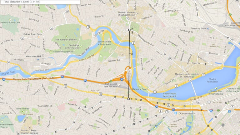
“As the crow flies’’ view of going from Boston University area to Harvard Square. It is about a mile and a half:
[fragment number=1]
The route Google maps tells you to take from Harvard Square to Logan Airport via the Red Line and the bus. It is 7.2 miles:
[fragment number=2]
“As the crow flies’’ view of Harvard Square to Logan. It is a little over 5 miles:
[fragment number=3]
Don’t you wish you were a crow?


To comment, please create a screen name in your profile
To comment, please verify your email address
Conversation
This discussion has ended. Please join elsewhere on Boston.com