Here’s where you can track power outages being reported in Massachusetts
The powerful nor’easter hitting the state on Friday and Saturday is bringing with it damaging winds that will likely cause power outages.
Related Links
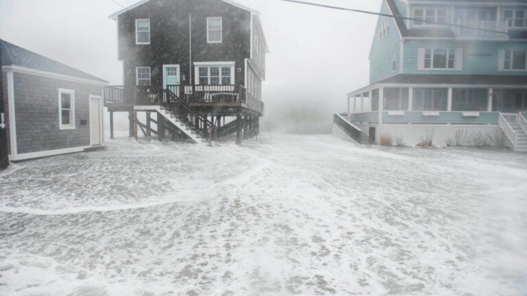
Forecasters and state officials are warning residents that the powerful coastal storm hitting Massachusetts on Friday and Saturday is expected to bring potentially destructive winds that could cause tree damage and power outages in parts of the state.
All shorelines are at risk for moderate to major coastal flooding and severe erosion. Heavy rain, and possibly snow, will also cause street flooding and significant rises in rivers and streams. Strong wind gusts may cause tree damage and scattered power outages. #MAwx
— Charlie Baker (@MAGovArchive) March 2, 2018
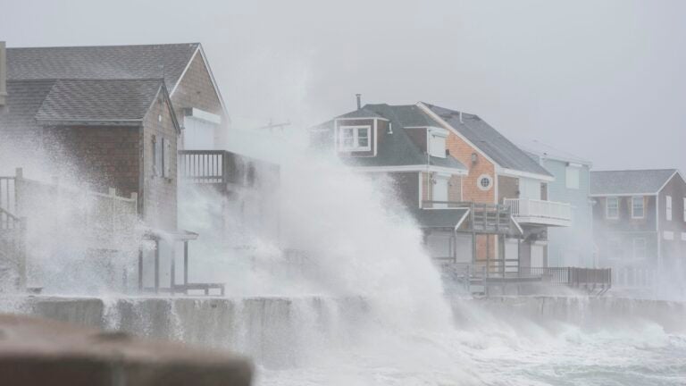
The National Weather Service said Friday morning it expects much of southern New England will experience “strong to damaging wind gusts.”
“For the Cape and Islands, we could see the potential for peak gusts near 70-80 mph if all ingredients come together,” service forecasters said. “This amount of wind will cause not only numerous powerline issues but even structural damage.”
The service has issued high wind advisories for parts of the state, and cautioned that the height of the winds are forecast for Friday afternoon into the evening.


The Massachusetts Emergency Management Agency is tracking power outages across the state, town-by-town. See their outage map here.
Utility companies Eversource, National Grid, and Unitil are tracking the outages with their updating maps: