4 things to know about how New England’s latest snowstorm will affect the beginning of your week
Here we go again.
Between the Patriots’ Super Bowl win and the successive February snowstorms, it’s beginning to feel a little like 2015 again.
Just after we shoveled ourselves out of last Thursday’s blizzard, New England is getting hit with another winter storm. With snow expected to fall on much of the region through Sunday into Monday morning, here are four things you should know about how it will affect the beginning of your work week.
1. It’ll hit like a one-two punch
Unlike the last storm, this one will hit in waves.
As Boston.com meteorologist David Epstein writes, the first half of the storm is expected to drop up to a half-foot of snow around Boston and southern New England — and even larger quantities farther north — by Sunday evening.
The second band begins early Monday morning, dropping more snow and creating the potential for another blizzard in coastal areas due to powerful winds.
2. But there’s still a lot we don’t know
Particularly with part two of the storm early Monday, forecasters are having trouble telling what exactly we should expect.
“Placement of rain-snow lines, the timing of low-pressure intensification and the exact location of the storm itself could all impact how much snow ends up in the record books Monday evening,” wrote Epstein.
What this means is, at the high end, heavy snow could continue Monday morning and Boston could end up with more than a foot when entire storm is said and done. Or, on the low end, Boston might only receive another couple inches Monday morning.
Basically, it all depends on the snow-lines and exactly how intense that second band is.
Check back later this evening for more updates on snowfall predictions. Expect the unexpected with this one. pic.twitter.com/WpU7avQzfF
— Dave Epstein (@growingwisdom) February 12, 2017
Here are six other maps (plus Epstein’s) taking their shot at projecting just how much snow Boston and the rest of New England will get. And follow Epstein on Twitter for continuing updates.
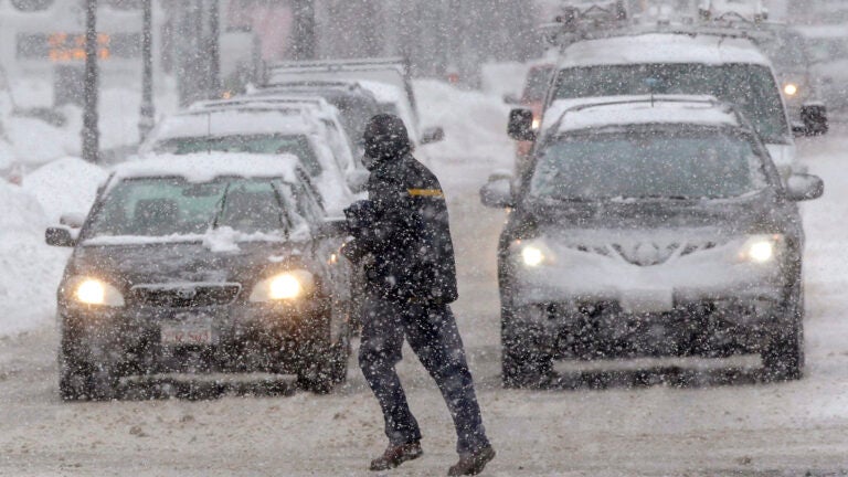
3. The commute Monday morning will be slow
Gov. Charlie Baker is asking residents to avoid unnecessary travel, but, if necessary, leave yourself extra time. The type of heavy, wet storm much of New England is expected to receive makes for messy and potentially dangerous roads — especially with high winds and some coastal flooding expected.
“As the storm continues, we ask everyone to use extreme caution when traveling and avoid unnecessary driving when possible,” Baker said in a statement Sunday.
From the New York border to Worcester, Massachusetts, state police have reduced the speed limit to 40 mph due to the weather.
The MBTA is expected to continue to run on a regular schedule Monday and largely fared well with Thursday’s storm. But that doesn’t mean there won’t be delays. Keep posted on the MBTA’s official Twitter feed or the service updates page on their website
#MBTA #Snowzilla was out on the #RedLine & #OrangeLine last night, prepping for more #MAsnow pic.twitter.com/uWjhSH8LAV
— MBTA (@MBTA) February 12, 2017
4. School
In a press conference Monday afternoon, Mayor Marty Walsh announced that Boston Public Schools will be closed Monday. The announcement came after several other local schools had already announced they had closed.
Check out WCVB’s searchable and alphabetical listing of all closures here.
The mayor encouraged residents to work from home or take public transportation on Monday, though libraries and City Hall — with scaled-back staffing — will remain open.
Walsh said a parking ban will go into effect at 8 p.m. Sunday — with the exception of Chinatown, where it will go into effect at 11 p.m. to accommodate for Chinese New Year celebrations. As for space savers, Walsh said that the 48-hour policy from Thursday’s storm emergency will be extended another 48 hours from the end of this snow emergency.
Watch’s Walsh’s full press conference on the storm here.
And to see what other ways the storm will affect your municipal day-to-day goings, go to your local town or city’s webpage for snow emergency updates. Here are a few quick links below: