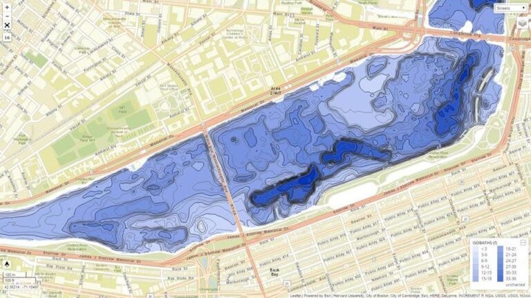
Charting project reveals Charles River’s depths
The Charles River Basin — at least, the one we recognize — was born on Oct. 20, 1908.
Before then, much of the waterway between Boston and Cambridge was an estuary, with expansive, foul-smelling mud flats emerging at low tide. But on that Tuesday more than a century ago, workers on the first dam at the mouth of the Charles lowered 84 massive timber gates into the water, creating the placid, lake-like river so familiar today.
Now, for the first time since it was submerged, the riverbed is coming back into view, this time in vivid digital detail. A Massachusetts Institute of Technology engineer and a longtime sailor and scientist have collaborated to create the most thorough, accurate chart of the lower Charles yet. It promises to become a foundational tool of multiple efforts to study, navigate, and manage the increasingly crowded Charles.
Read the complete story at BostonGlobe.com.
Don’t have a Globe subscription? Boston.com readers get a 2-week free trial.


To comment, please create a screen name in your profile
To comment, please verify your email address
Conversation
This discussion has ended. Please join elsewhere on Boston.com