Scenes from Maine’s coastal islands
-

There are over 4,000 islands in Maine, and almost all of them are covered in moss, fog, berries, and birds. Some are remote and tough to visit. Others are fastened to the land by bridge or causeway. Here are four island adventures that are close to shore but feel like a world away. – By Jonathan Levitt, Globe correspondent
-

The village of Stonington on the southern tip of Deer Isle is strategically placed for a world of sailboats and steamer ships. The town was built on granite and cod but then came industrialization and the automobile, and all of a sudden Stonington was at the end of the road instead of right in the middle of it. The graceful village is built into a steep hillside facing the sea. It is best approached from the shore, but these days most people get there on the blacktop.
-

When you have loaded up, head for the dramatic, 75-year-old suspension bridge that spans Eggemoggin Reach from Sedgewick to Deer Isle. Drive over the bridge, then over a causeway, drive and drive, and eventually the road ends in Stonington. It feels like the end of the earth. Just because a person drives here does not make Deer Isle any less an island.
-

The trail from the road to the island winds through spruce and fir, the ground a thick carpet of lichens, mosses, and mushrooms. After walking for about an hour through the rain and the mosquitoes, you will reach the shore. At low tide you can stroll over the sandbar. Stand on Barred Island’s dome of pink granite. The sea breeze keeps the bugs away. Harbor seals play in the rockweeds.
-

Fishing remains a cornerstone of the village’s economy.
-

Curtis Island is a seven-acre refuge in the mouth of yacht-choked Camden Harbor. It is a perfect destination for a late summer picnic.
-

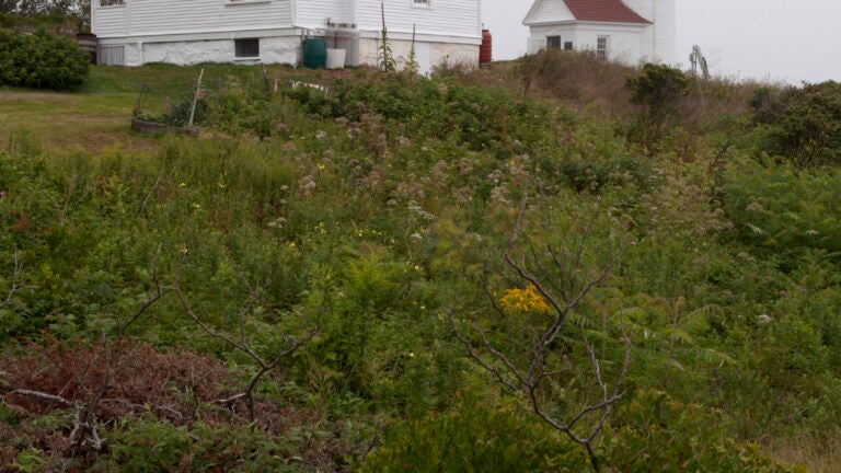
The current 25-foot-tall lighthouse tower was built in 1896. If the caretaker is around he might open the door. Climb the iron stairs to the top and you can see east all the way to Cadillac Mountain.
-

Islesboro is 14 miles long and in most places about a mile wide. The Native Americans called it Pitaubegwimenahanuk, which means “the island that lies between two channels.’’ It is a sweet and gentle place, old farmland really, hardly the dramatic cliffs and crashing waves of the outer seaward islands.
-

Look for clam and lobster bakes along the Islesboro shore.
-

The island of Malaga sits at the mouth of the New Meadows River about 300 yards offshore from the village of Sebasco in eastern Casco Bay. On the northern tip of the wild 42-acre island there is a sign of settlement — a heap of shells — a midden bleached pure white from the sun and salt. Beyond that there is a meadow of tall grasses, old apple trees, and overgrown lilac.
-

For 50 years, beginning in the 1860s, Malaga was home to a racially diverse fishing community of about 45 people. The islanders caught groundfish and trapped lobster, picked berries, dug clams, grew vegetables, and kept animals. Malaga was one of the last refuges for poor fishing families around rapidly developing Casco Bay.


To comment, please create a screen name in your profile
To comment, please verify your email address
Conversation
This discussion has ended. Please join elsewhere on Boston.com