Where people in Boston take the most photos, shown in one map
Mapbox created a heatmap using geo-tagging and user data.
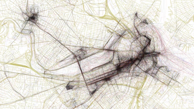
Some initial guesses as to Boston’s most photographed locations might be: the steps of the State House, from the top of the Hub, or overlooking a Sox game at Fenway. But with this map, there’s no guessing necessary.
Mapbox is a tool that uses data from platforms like Runkeeper to create custom maps. This project called “Geotaggers’ World Atlas” shows routes photographers follow when taking pictures around cities like New York, Berlin, and Boston. Mapbox’s Eric Fisher used locations of photos uploaded to Flickr, a photo hosting website and application, over the course of ten years to plot his data.
Click here to see Mapbox’s interactive map.
“A sequence of photos along a route is even more significant, because it indicates that someone sustained their interest over distance and time rather than taking one picture and turning back,” Fisher wrote in a blog post when he released the project in 2015.
Based on what is plotted in Fisher’s map of Boston, it looks like Harvard Square, Boston Common, and Downtown Crossing provide some of the most scenic routes for picture-takers.
See the map of Boston that Fisher created above.


To comment, please create a screen name in your profile
To comment, please verify your email address
Conversation
This discussion has ended. Please join elsewhere on Boston.com